Hinterland walks at Bulahdelah, Copeland Tops and Gloucester Tops, with plenty of other great walks in between.
Curious about our best hinterland walks with lookouts and more?
Here are our suggestions for the top hinterland walks of the Barrington Coast, including a few with waterfalls as the reward.
Some are easy, some are a little more challenging, but you'll love them all.
Strap on those walking shoes and you'll be rewarded at every turn with something special. And if you still want more then check out our coastal walks and waterfall walks.
But first... shinrin-yoku
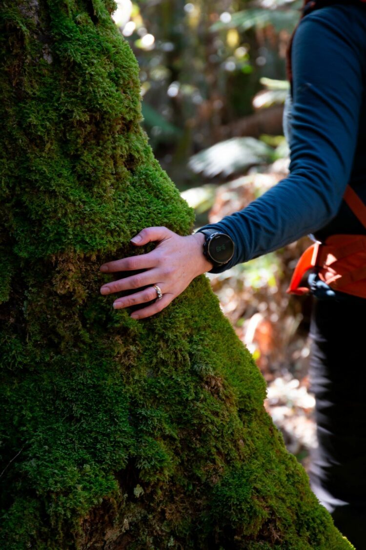
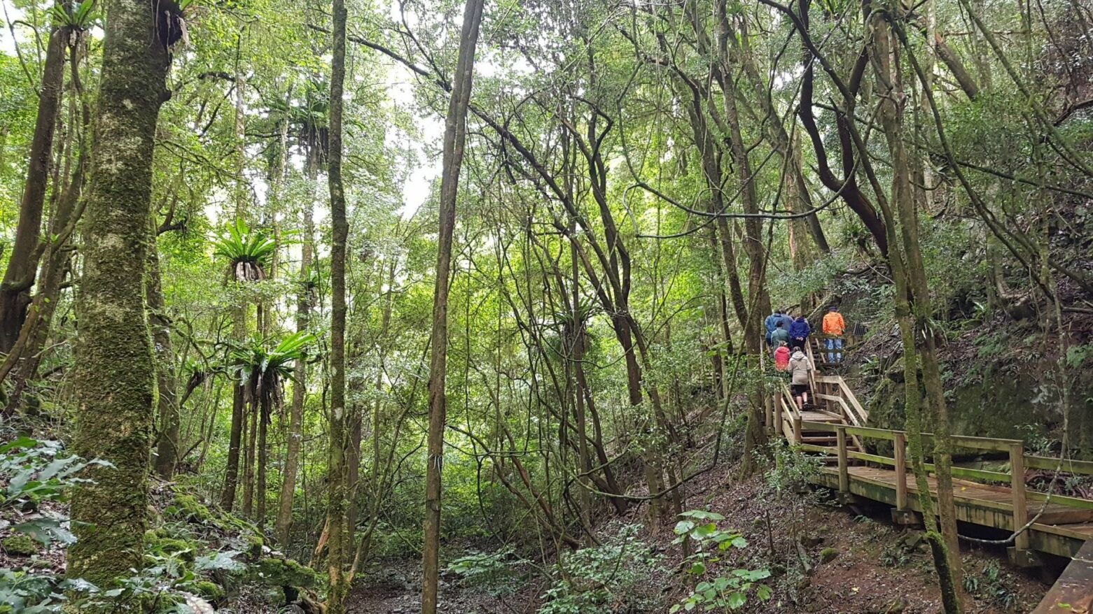
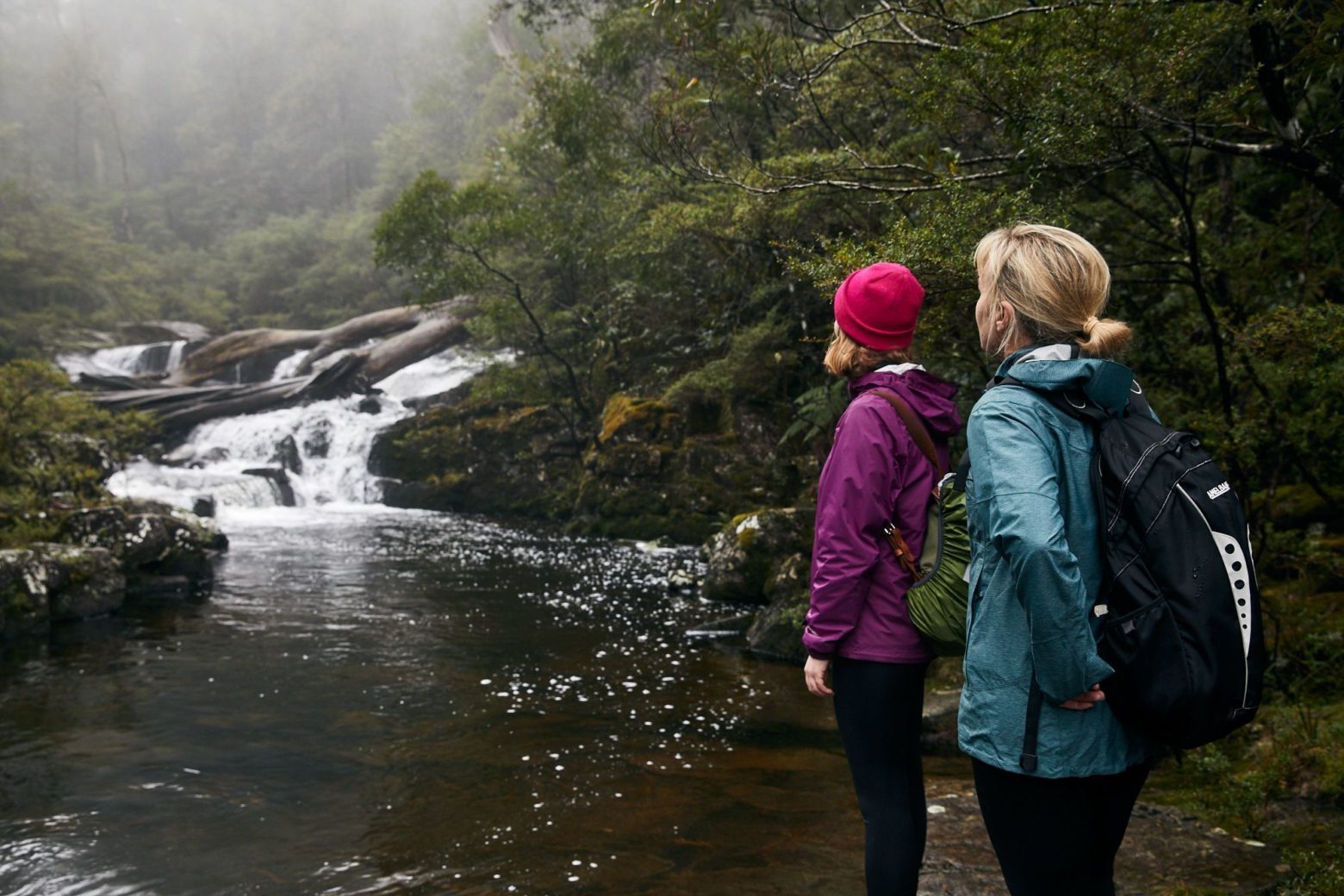
Do you feel kind of special walking through beautiful forests? The Japanese have a word for it: shinrin-yoku, which means forest bathing, or taking in the forest through your senses.
It’s not exercise or hiking or jogging. It is simply being in nature, connecting with it through our senses of sight, hearing, taste, smell and touch. Shinrin-yoku is like a bridge. By opening our senses, it bridges the gap between us and the natural world.
The forests of the Barrington Coast are perfect for experiencing shinrin-yoku, from the high altitude Gondwana rainforests of the Barrington Tops parklands to the coastal forests of Booti Booti, Crowdy Bay and Myall Lakes National Parks.
** Safety tip: Always check NPWS Alerts before departing for a National Park, Nature Reserve or State Conservation Area **
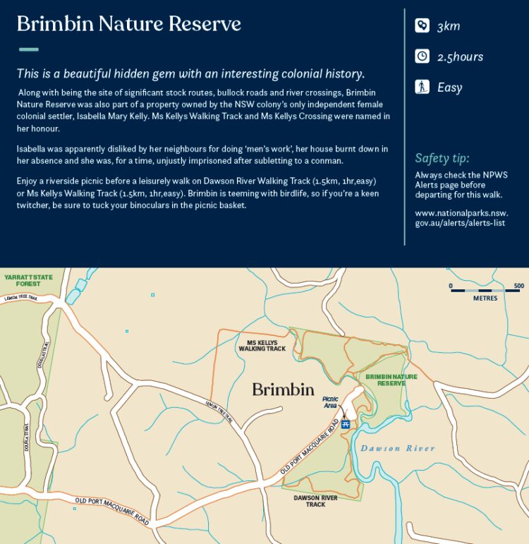
Brimbin Nature Reserve
- 3km
- 2.5 hours
- Easy
This is a beautiful hidden gem with an interesting colonial history.
Along with being the site of significant stock routes, bullock roads and river crossings, Brimbin Nature Reserve was also part of a property owned by the NSW colony’s only independent female colonial settler, Isabella Mary Kelly. Ms Kellys Walking Track and Ms Kellys Crossing were named in her honour.
Isabella was apparently disliked by her neighbours for doing ‘men’s work’, her house burnt down in her absence and she was, for a time, unjustly imprisoned after subletting to a conman.
Enjoy a riverside picnic before a leisurely walk on Dawson River Walking Track (1.5km, 1 hour, easy) or Ms Kellys Walking Track (1.5km, 1 hour, easy).
Brimbin is teeming with birdlife, so if you’re a keen twitcher, be sure to tuck your binoculars in the picnic basket.
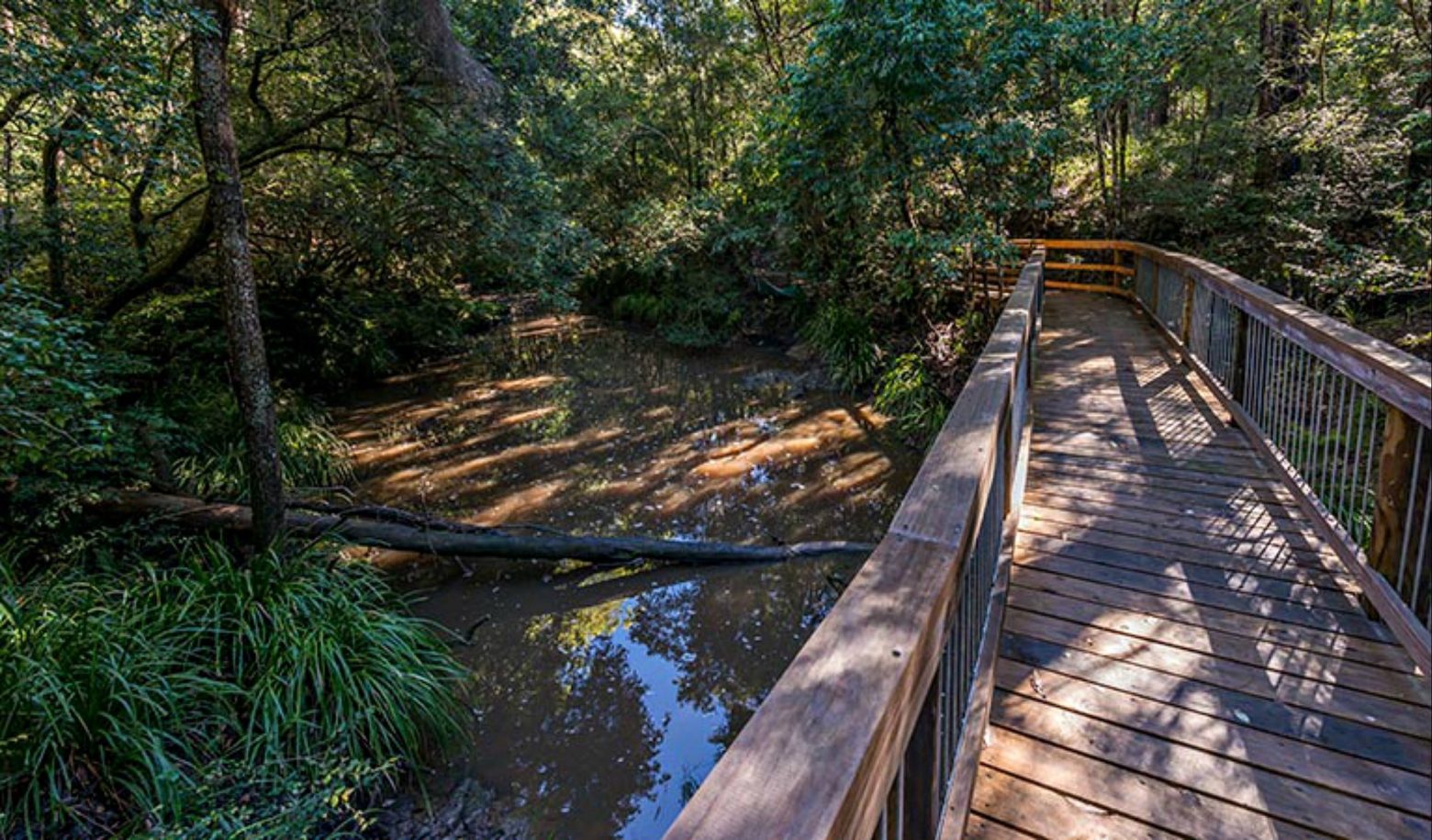
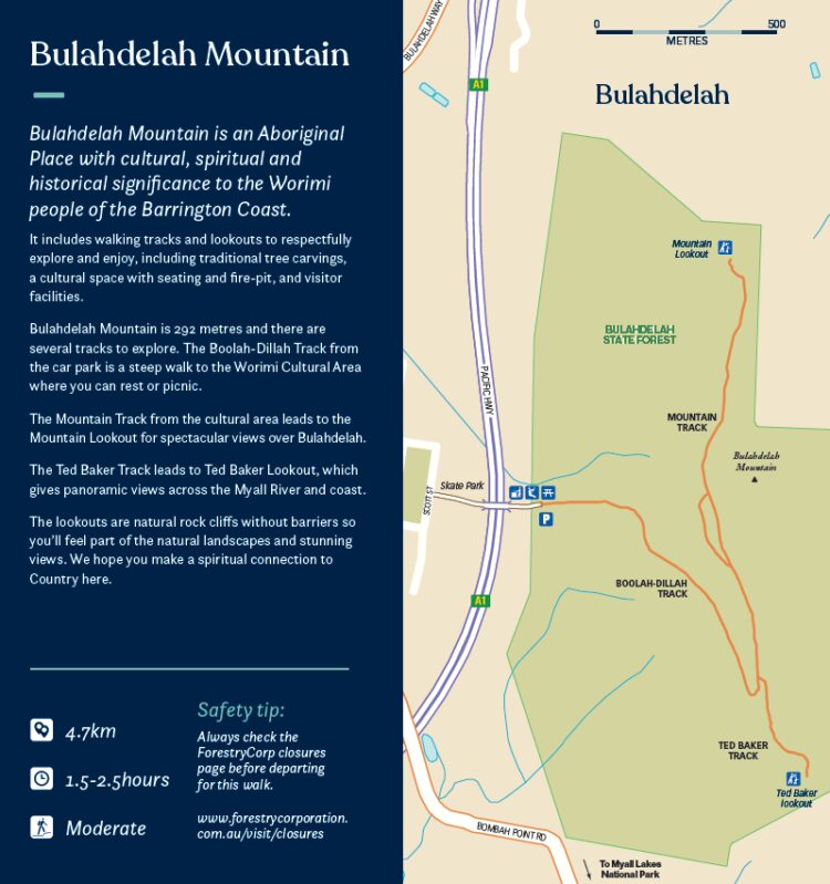
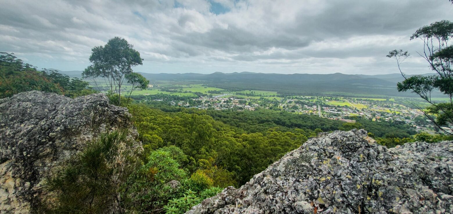
Bulahdelah Mountain
- 4.7km
- 1.5-2.5 hours
- Moderate
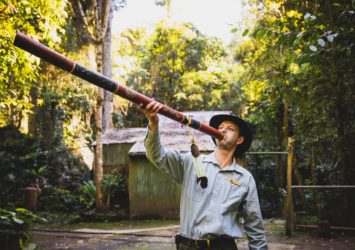
Bulahdelah Mountain is an Aboriginal Place with cultural, spiritual and historical significance to the Worimi people of the Barrington Coast.
It includes walking tracks and lookouts to respectfully explore and enjoy, including traditional tree carvings, a cultural space with seating and fire-pit, and visitor facilities.
Bulahdelah Mountain is 292 metres and there are several tracks to explore. The Boolah-Dillah Track from the car park is a steep walk to the Worimi Cultural Area where you can rest or picnic.
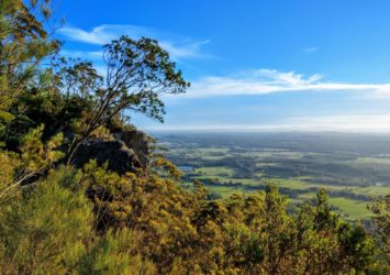
The Mountain Track from the cultural area leads to the Mountain Lookout for spectacular views over Bulahdelah.
The Ted Baker Track leads to Ted Baker Lookout, which gives panoramic views across the Myall River and coast.
The lookouts are natural rock cliffs without barriers so you’ll feel part of the natural landscapes and stunning views. We hope you make a spiritual connection to Country here.
** Safety tip: Always check ForestryCorp closures before departing for this state forest walk **
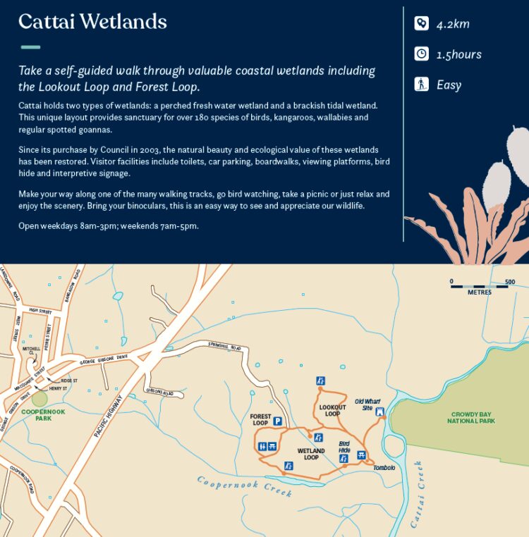
Cattai Wetlands
- 4.2km
- 1.5 hours
- Easy
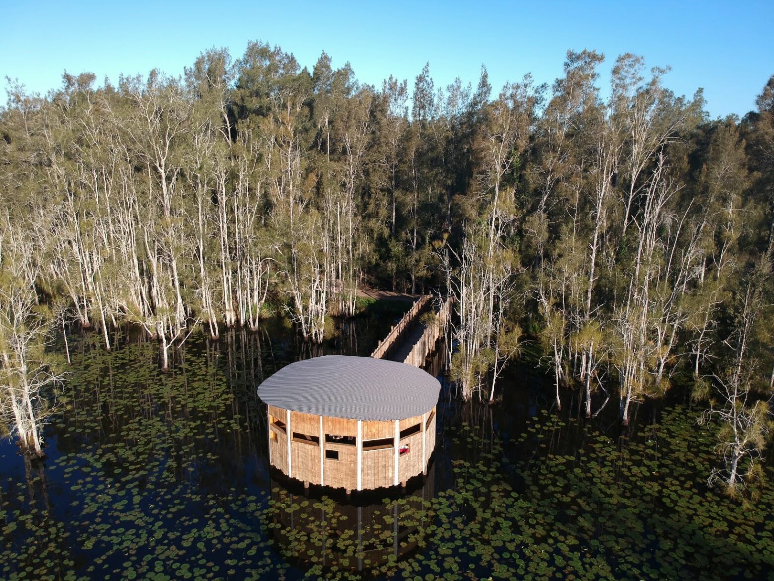
Not far from the broad sands of Harrington is Cattai Wetlands. Take a self-guided walk through these valuable coastal wetlands including the Lookout Loop and Forest Loop.
Cattai holds two types of wetlands: a perched fresh water wetland and a brackish tidal wetland. This unique layout provides sanctuary for over 180 species of birds, kangaroos, wallabies and regular spotted goannas.
Since its purchase by Council in 2003, the natural beauty and ecological value of these wetlands has been restored. Visitor facilities include toilets, car parking, boardwalks, viewing platforms, bird hide and interpretive signage.
Make your way along one of the many walking tracks, go bird watching, take a picnic or just relax and enjoy the scenery. Bring your binoculars, this is an easy way to see and appreciate our wildlife.
Open weekdays 8am-3pm; weekends 7am-5pm.
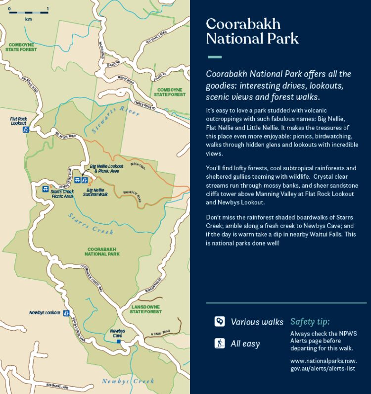
Coorabakh National Park
- Various walks
- All easy
Coorabakh National Park offers all the goodies: interesting drives, lookouts, scenic views and forest walks.
It’s easy to love a park studded with volcanic outcroppings with such fabulous names: Big Nellie, Flat Nellie and Little Nellie. It makes the treasures of this place even more enjoyable: picnics, birdwatching, walks through hidden glens and lookouts with incredible views.
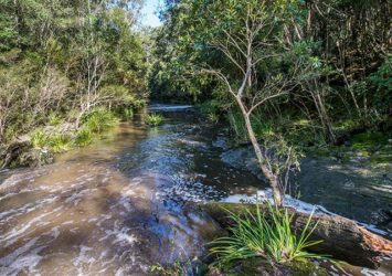
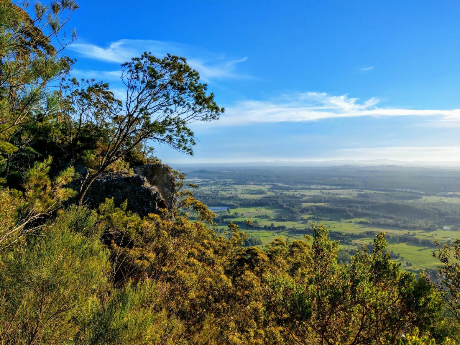
You’ll find lofty forests, cool subtropical rainforests and sheltered gullies teeming with wildlife. Crystal clear streams run through mossy banks, and sheer sandstone cliffs tower above Manning Valley at Flat Rock Lookout and Newbys Lookout.
Don’t miss the rainforest shaded boardwalks of Starrs Creek; amble along a fresh creek to Newbys Cave; and if the day is warm take a dip in nearby Waitui Falls. This is national parks done well!
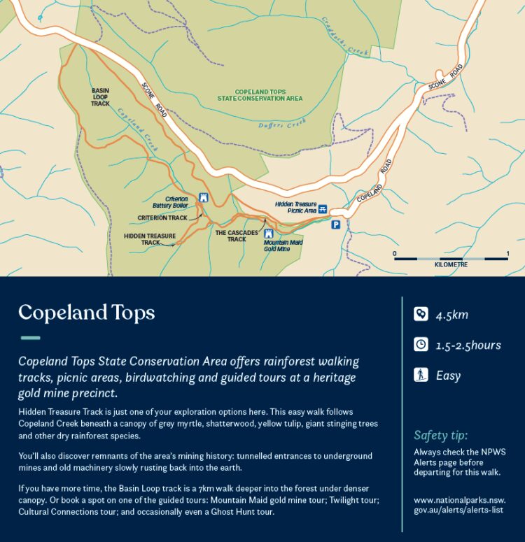
Copeland Tops
- 4.5km
- 1.5-2.5 hours
- Easy
Copeland Tops State Conservation Area offers rainforest walking tracks, picnic areas, birdwatching and guided tours at a heritage gold mine precinct.
Hidden Treasure Track is just one of your exploration options here. This easy walk follows Copeland Creek beneath a canopy of grey myrtle, shatterwood, yellow tulip, giant stinging trees and other dry rainforest species.
You’ll also discover remnants of the area’s mining history: tunnelled entrances to underground mines and old machinery slowly rusting back into the earth.
If you have more time, the Basin Loop track is a 7km walk deeper into the forest under denser canopy.
Or book a spot on one of the guided tours: Mountain Maid gold mine tour; Twilight tour; Cultural Connections tour; and occasionally even a Ghost Hunt tour.
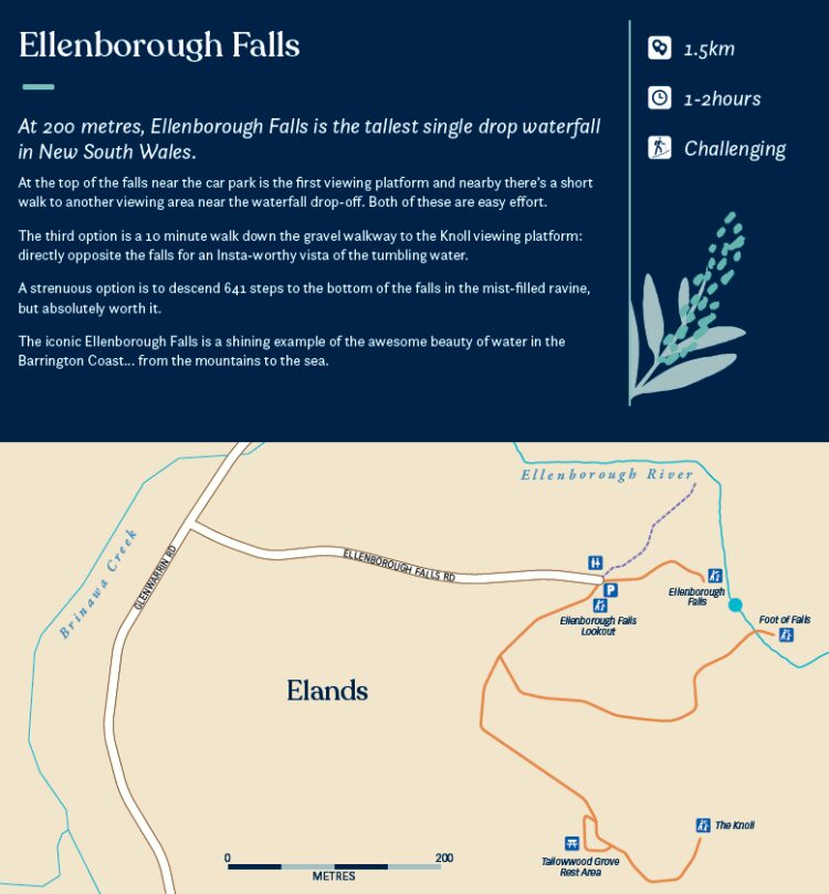
Ellenborough Falls, Elands
- 1.5km with 641 steps
- 1-2 hours
- Challenging
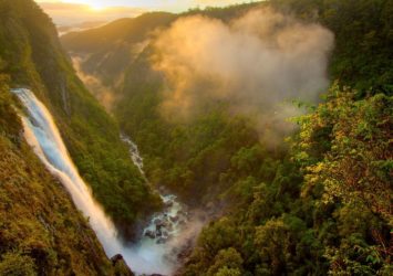
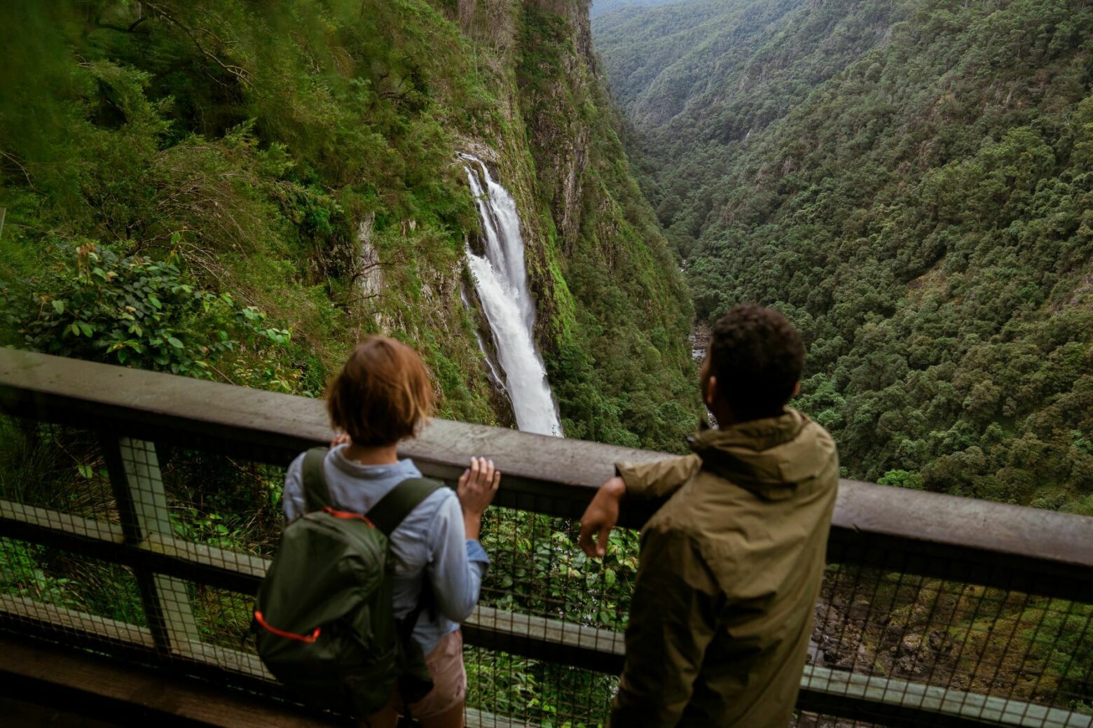
At 200 metres, Ellenborough Falls is the tallest single drop waterfall in New South Wales.
At the top of the falls near the car park is the first viewing platform and nearby there's a short walk to another viewing area near the waterfall drop-off. Both of these are easy effort.
The third option is a 10 minute walk down the gravel walkway to the Knoll viewing platform: directly opposite the falls for an Insta-worthy vista of the tumbling water.
A strenuous option is to descend 641 steps to the bottom of the falls in the mist-filled ravine, but absolutely worth it.
The iconic Ellenborough Falls is a shining example of the awesome beauty of water in the Barrington Coast… from the mountains to the sea.
Caution: Take extreme care if you choose to swim in the rocky pool at the bottom of the falls.
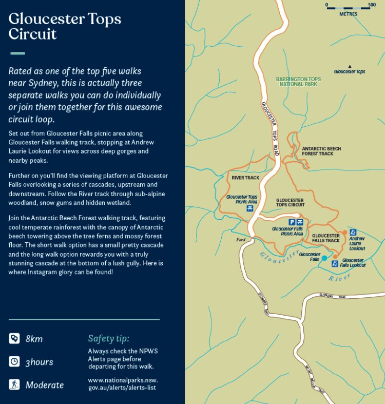
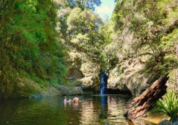
Gloucester Tops Circuit
- 8km
- 3 hours
- Moderate
This is rated as one of the top five walks near Sydney, so you really shouldn't miss seeing it. It's actually three separate walks you can do individually or join them together for this awesome circuit loop.
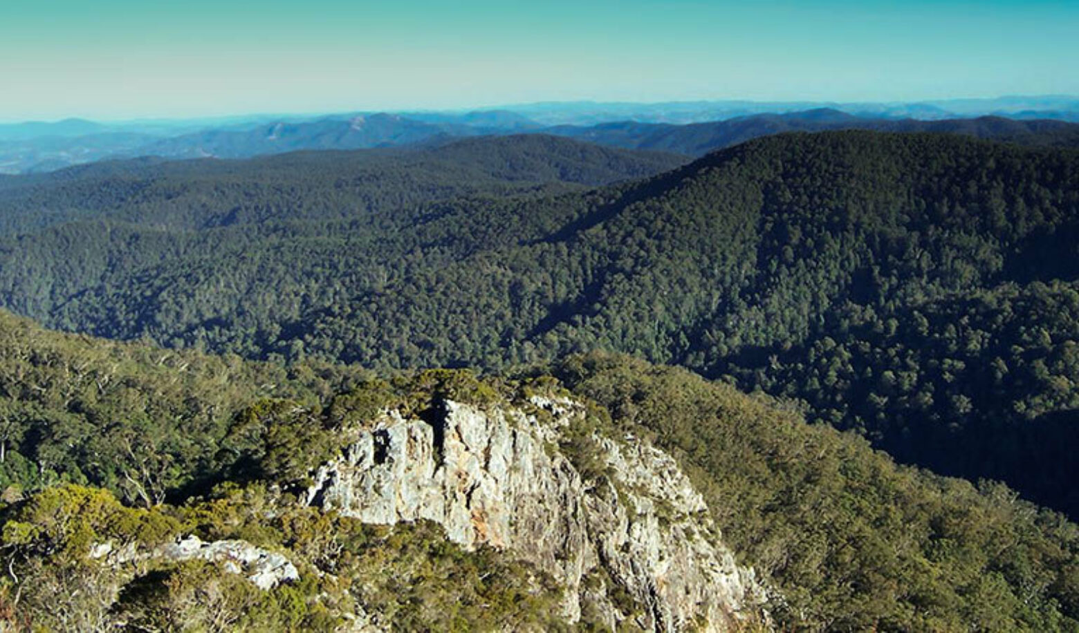
Set out from Gloucester Falls picnic area along Gloucester Falls walking track, stopping at Andrew Laurie Lookout for views across deep gorges and nearby peaks.
Further on you’ll find the viewing platform at Gloucester Falls overlooking a series of cascades, upstream and downstream. Follow the River track through sub-alpine woodland, snow gums and hidden wetland.
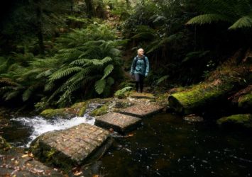
Join the Antarctic Beech Forest walking track, featuring cool temperate rainforest with the canopy of Antarctic beech towering above the tree ferns and mossy forest floor. The short walk option has a small pretty cascade and the long walk option rewards you with a truly stunning cascade at the bottom of a lush gully. Here is where Instagram glory can be found!
If you're heading to Barrington Tops the best approach is via Gloucester on the eastern side, stop for fuel, provisions, a coffee or a meal on your way through.
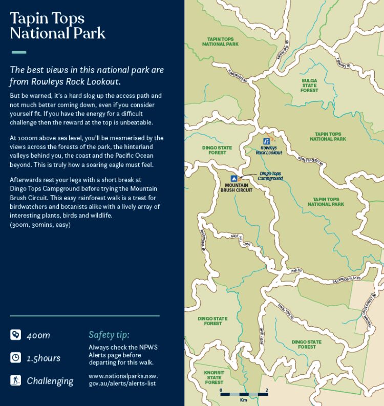
Tapin Tops National Park
- 400m
- 1.5 hours
- Challenging
The best views in this national park are from Rowleys Rock Lookout.
But be warned, it’s a hard slog up the access path and not much better coming down, even if you consider yourself fit. If you have the energy for a difficult challenge then the reward at the top is unbeatable.
At 1000m above sea level, you’ll be mesmerised by the views across the forests of the park, the hinterland valleys behind you, the coast and the Pacific Ocean beyond. This is truly how a soaring eagle must feel.
Afterwards rest your legs with a short break at Dingo Tops Campground before trying the Mountain Brush Circuit. This easy rainforest walk is a treat for birdwatchers and botanists alike with a lively array of interesting plants, birds and wildlife. (300m, 30 minutes, easy)
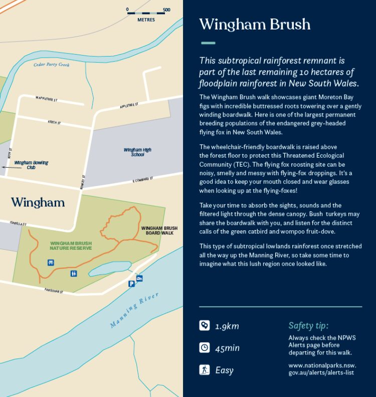
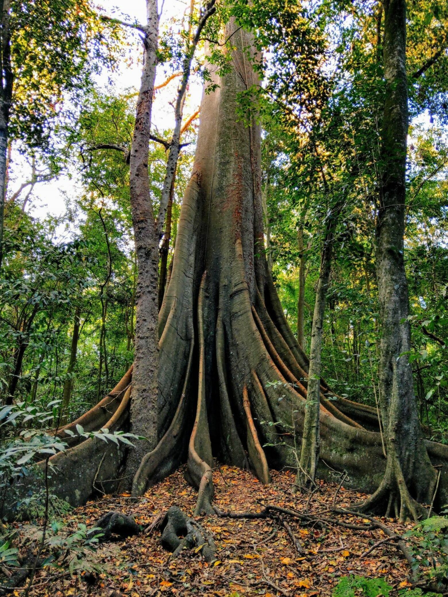
Wingham Brush
- 1.9km
- 45 minutes
- Easy
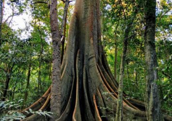
This subtropical rainforest remnant is part of the last remaining 10 hectares of floodplain rainforest in New South Wales.
The Wingham Brush walk showcases giant Moreton Bay figs with incredible buttressed roots towering over a gently winding boardwalk. Here is one of the largest permanent breeding populations of the endangered grey-headed flying fox in New South Wales.
Take your time to absorb the sights, sounds and the filtered light through the dense canopy. Scrub turkeys may share the boardwalk with you, and listen for the distinct calls of the green catbird and wompoo fruit-dove.
This type of subtropical lowlands rainforest once stretched all the way up the Manning River, so take some time to imagine what this lush region once looked like.