Our best waterfalls at Ellenborough, Potoroo, Gloucester Tops and Waitui.
Curious about our best walks with waterfalls as the reward?
Here are our suggestions for the top hinterland waterfalls of the Barrington Coast.
Some are easy, some are a little more challenging, but you'll love them all.
If you still want more then check out our coastal walks and other hinterland walks.
Strap on those walking shoes and you'll be rewarded at every turn with something special.
Ok, let's go for a walk!
** Safety tip: Always check NPWS Alerts before departing for a National Park, Nature Reserve or State Conservation Area **
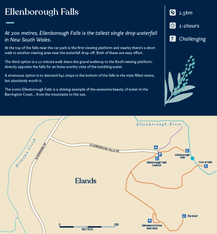
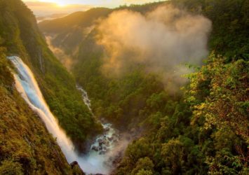
Ellenborough Falls
- 1.5km
- 1-2 hours
- Eay to Challenging
At 200 metres, Ellenborough Falls is the tallest single drop waterfall in New South Wales.
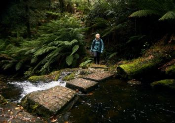
At the top of the falls near the car park is the first viewing platform and nearby there's a short walk to another viewing area near the waterfall drop-off. Both of these are easy effort.
The third option is a 10 minute walk down the gravel walkway to the Knoll viewing platform: directly opposite the falls for an Insta-worthy vista of the tumbling water.
A strenuous option is to descend 641 steps to the bottom of the falls in the mist-filled ravine, but absolutely worth it.
The iconic Ellenborough Falls is a shining example of the awesome beauty of water in the Barrington Coast… from the mountains to the sea.
Caution: Take extreme care if you choose to swim in the rocky pool at the bottom of the falls.
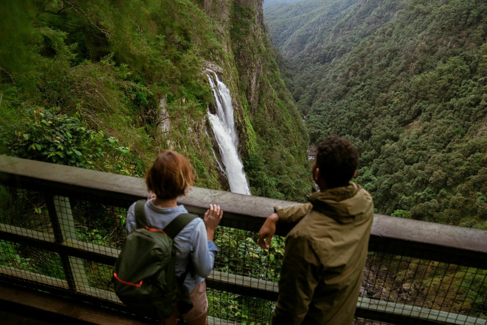
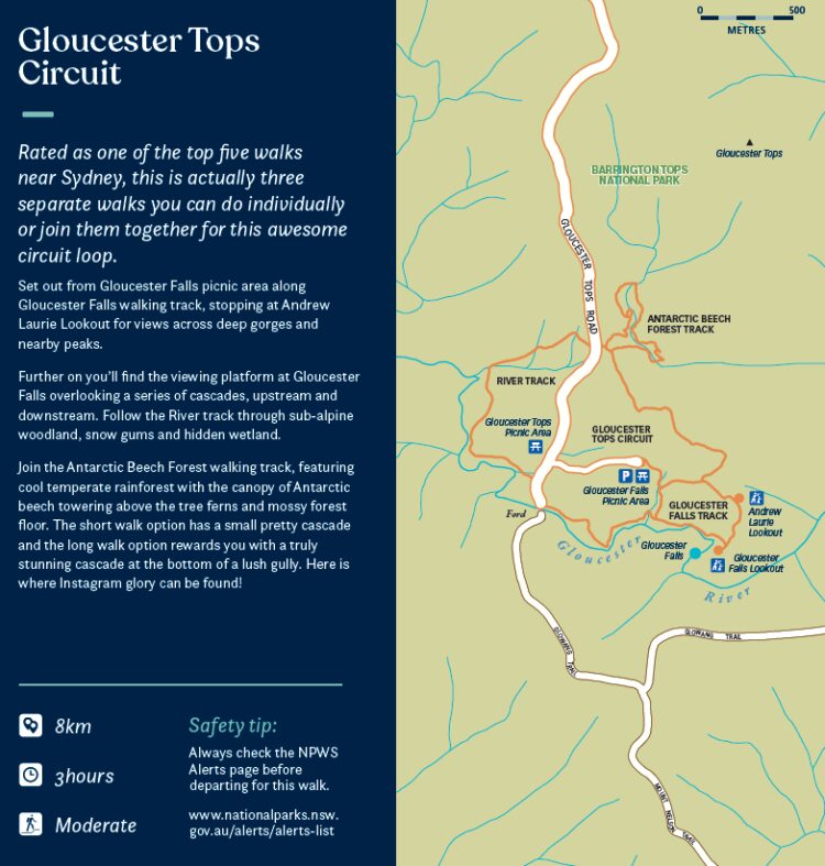
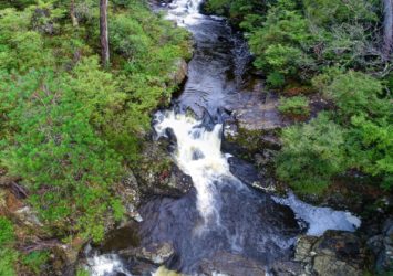
Gloucester Falls and more
- 8km for full circuit loop
- 3 hours
- Moderate
The Gloucester Tops Circuit is rated as one of the top five walks near Sydney, so you really shouldn't miss seeing it. It's actually three separate walks including the Gloucester Falls Walk... do them individually or join them together for this awesome circuit loop.
Set out from Gloucester Falls picnic area along Gloucester Falls walking track, stopping at Andrew Laurie Lookout for views across deep gorges and nearby peaks.
Further on you’ll find the viewing platform at Gloucester Falls overlooking a series of cascades, upstream and downstream. Follow the River track through sub-alpine woodland, snow gums and hidden wetland.
Join the Antarctic Beech Forest walking track, featuring cool temperate rainforest with the canopy of Antarctic beech towering above the tree ferns and mossy forest floor. The short walk option has a small pretty cascade and the long walk option rewards you with a truly stunning cascade at the bottom of a lush gully. Here is where Instagram glory can be found!
If you're heading to Barrington Tops the best approach is via Gloucester on the eastern side, stop for fuel, provisions, a coffee or a meal on your way through.
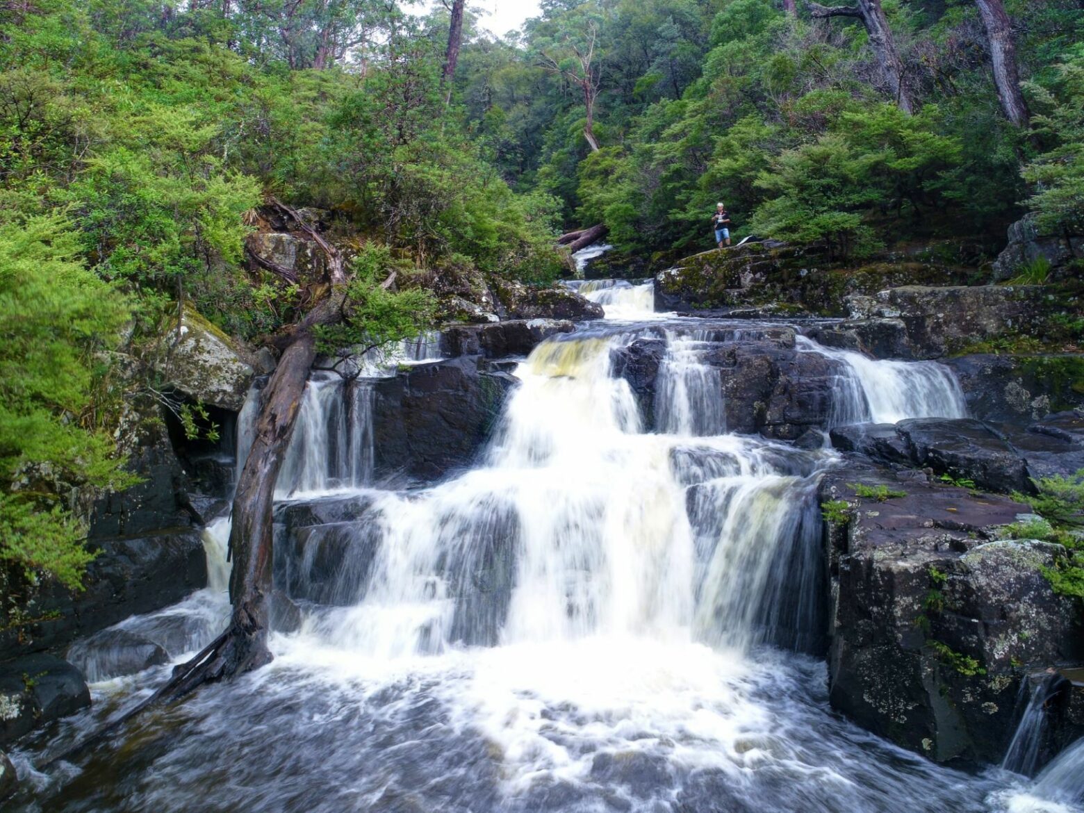
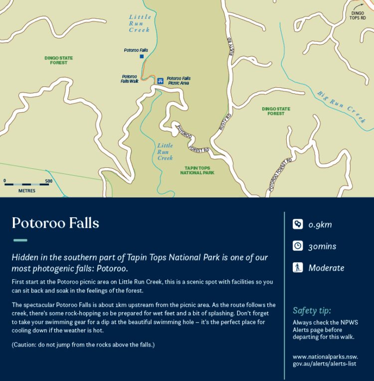
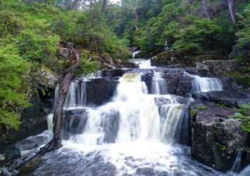
Potoroo Falls
- 0.9km
- 30 minutes
- Moderate
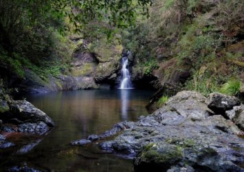
Hidden in the southern part of Tapin Tops National Park is one of our most photogenic falls: Potoroo.
First start at the Potoroo picnic area on Little Run Creek, this is a scenic spot with facilities so you can sit back and soak in the feelings of the forest.
The spectacular Potoroo Falls is about 1km upstream from the picnic area. As the route follows the creek, there’s some rock-hopping so be prepared for wet feet and a bit of splashing. Don’t forget to take your swimming gear for a dip at the beautiful swimming hole – it’s the perfect place for cooling down if the weather is hot.
Caution: do not jump from the rocks above the falls.
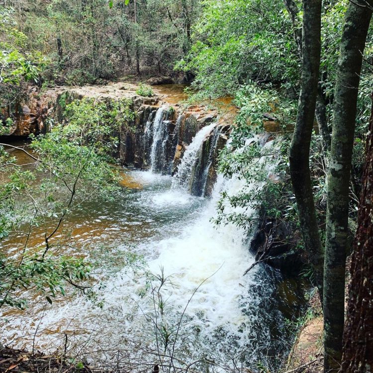
Waitui Falls
- 50m
- 5 minutes
- Easy
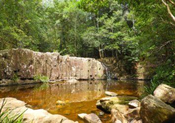
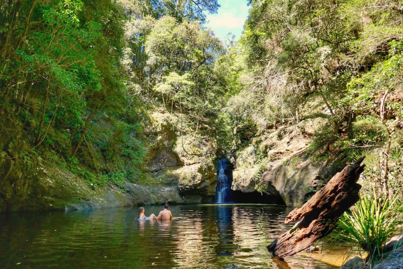
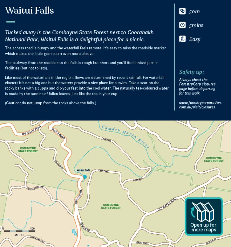
Tucked away in the Comboyne State Forest next to Coorabakh National Park, Waitui Falls is a delightful place for a picnic.
The access road is bumpy and the waterfall feels remote. It’s easy to miss the roadside marker which makes this little gem seem even more elusive.
The pathway from the roadside to the falls is rough but short and you’ll find limited picnic facilities (but not toilets).
Like most of the waterfalls in the region, flows are determined by recent rainfall. For waterfall chasers it’s not a big one but the waters provide a nice place for a swim. Take a seat on the rocky banks with a cuppa and dip your feet into the cool water. The naturally tea-coloured water is made by the tannins of fallen leaves, just like the tea in your cup.
Caution: do not jump from the rocks above the falls.