Take a self-guided walk through valuable coastal wetlands at Cattai.
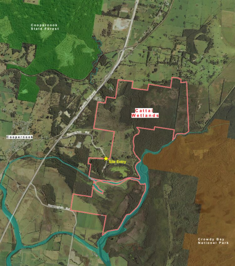
Just off the Pacific Highway at Spring Hill Road lives Cattai Wetlands, a beautiful coastal wetland and hidden gem of the Barrington Coast.
Cattai holds two types of wetlands: a perched fresh water wetland and a brackish tidal wetland. This unique layout provides sanctuary for over 180 species of birds, kangaroos, wallabies and regular spotted goannas. Make your way along one of the many walking tracks, go bird watching, take a picnic or just relax and enjoy the scenery.
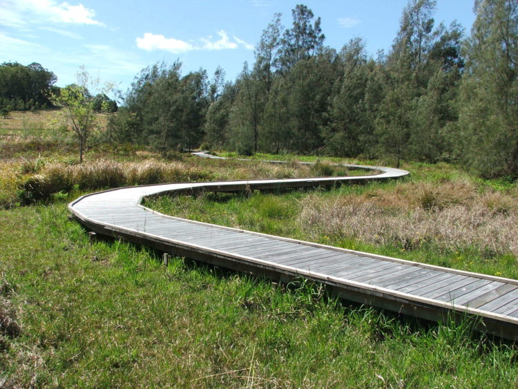
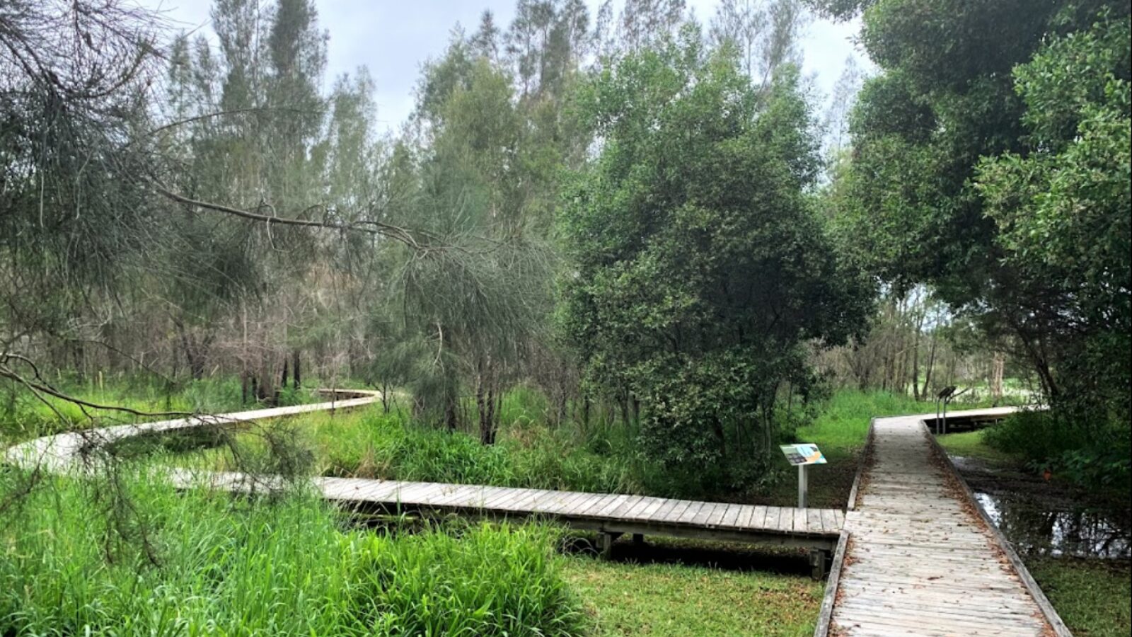
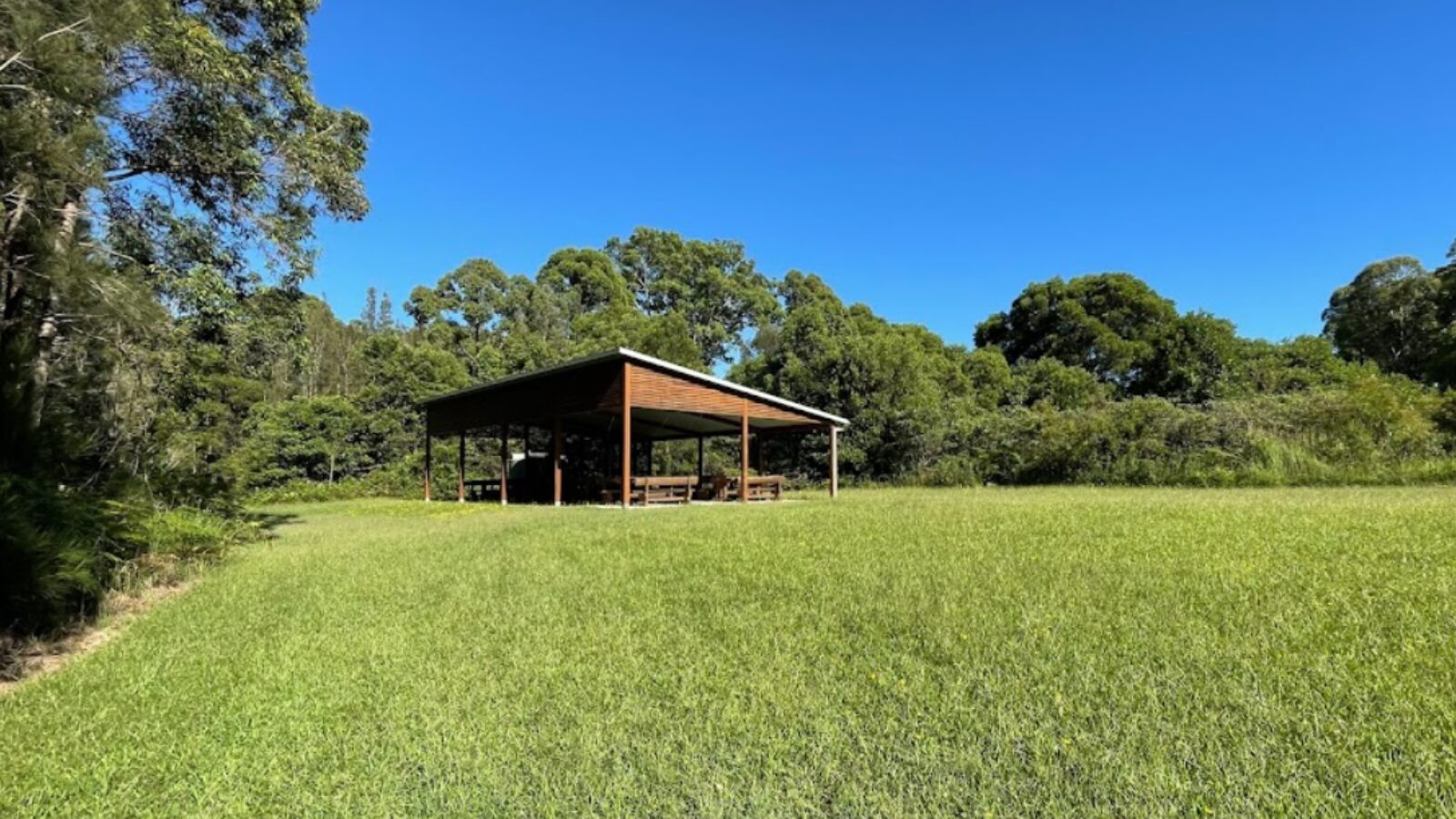
Visitor facilities include toilets, car parking, boardwalks, viewing platforms and interpretive signage.
Recent history of Cattai
MidCoast Council purchased Cattai in 2003 to restore the natural beauty and ecological value of the wetlands. At the time it was farmland suffering the effects of land clearing, weeds and acid sulfate soils. While the primary goal was improving the water quality of the Manning River through the remediation of acid sulfate soils, a range of other environmental benefits have also been achieved. This includes the rehabilitation of coastal wetlands and other endangered floodplain communities.
The project area is bounded by Cattai Creek and Crowdy Bay National Park to the east, Tappin Creek and Manning River to the south, the Pacific Highway to the west and Moorland and Big Swamp to the north.
Following extensive replanting and weed control, Cattai Wetlands now acts as an important wildlife corridor between Crowdy Bay National Park and the Lansdowne escarpment. All this has been achieved in partnership with various organisations and government agencies, indigenous green teams and community volunteers.
This is an exceptionally good outcome for our region's natural systems and one that can be enjoyed by visitors for generations.
Download the Hunter Bird Observers Club brochure for Cattai Wetlands Bird Route.
The walks around Cattai Wetlands
Cattai Wetlands are closed (and the entry gate locked) at 3pm on weekdays and 5pm on weekends so plan your visit accordingly.
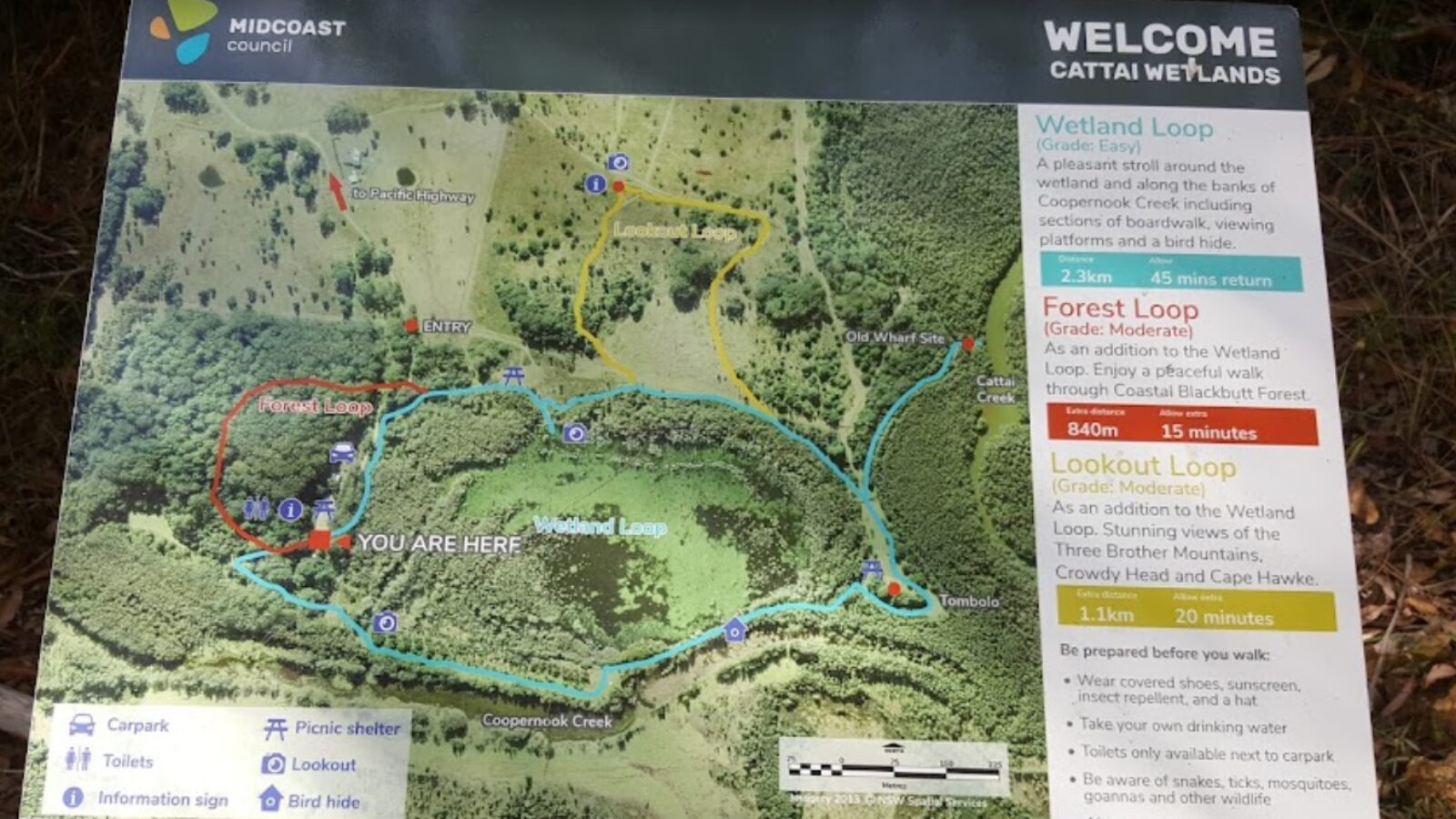
Below you'll find helpful information about the points of interest along the walking track which encircles a perched freshwater wetland, a distinctive feature of the Cattai Wetlands. The walk ahead is a 2.3km round trip and with stops along the way. This will take the average walker about an hour to complete.
The following optional walking tracks are also available:
- Lookout Loop: will add an extra 1.1km to your walk or 20 minutes and provides stunning views of the Three Brother Mountains.
- Forest Loop: will add an extra 840m to your walk, or 15 minutes and provides a shady walk through coastal Blackbutt forest
Be Prepared
- Wear covered shoes, sunscreen, insect repellent, a hat and take a mobile phone and your own drinking water.
- Toilets are only available next to the car park.
- Be aware of the presence of snakes, ticks, mosquitoes, goannas and other wildlife that live here.
- Some tracks may have trip hazards such as fallen branches and roots - they are not suitable for wheelchairs.
- Do not walk the Forest Loop in high winds.
- Swimming is not permitted.
- Always supervise children near water bodies.
- The water depth in the wetland varies with a maximum depth of 800mm.
Stop 1: Giant climbing maidenhair
Located just off the track in the forest you will see a rare example of a giant climbing maidenhair fern (Lygodium microphyllum), usually found growing north of Coffs Harbour. The fern can grow up to 8m tall and 3m wide at the base of the climbing mount. Several of these ferns are located within the Cattai Wetlands at the base of paperbark trees.
Stop 2: Bladderwort
During the summer months, you will notice within the dam a yellow flowering plant known as the bladderwort (Utricularia sp.). The bladderwort is a carnivorous aquatic plant that has tiny bladders (balloon-like sacks) along its stems. When tiny insects swim past these bladders they trigger small sensor hairs which open a trapdoor and suck the insect inside the bladder using a vacuum.
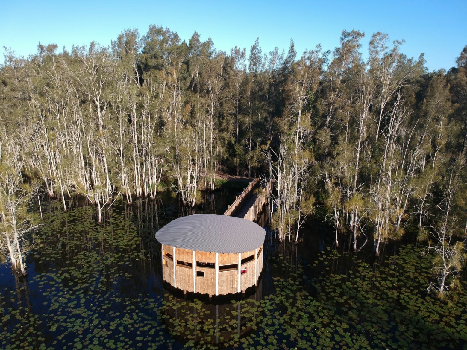
Stop 3: Wetland view
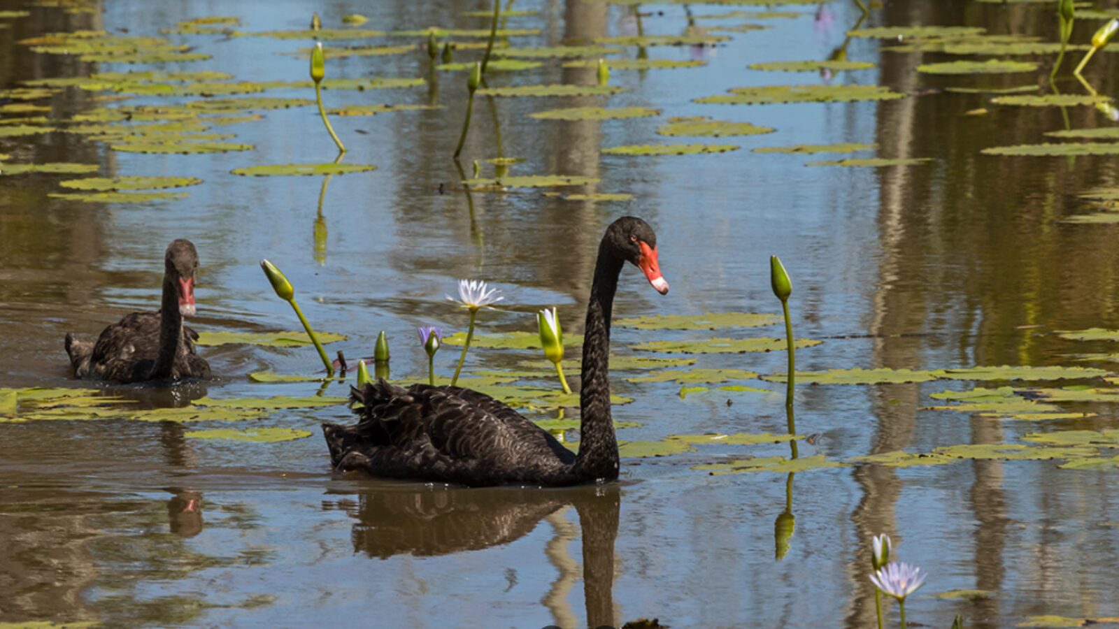
Follow the boardwalk off to the right to view the vast expanse of the wetland itself and its abundant bird life including the majestic black swan. Between spring and autumn the wetland is covered in the cape watertily (Nymphaea sp.) a native of South America which has spectacular purple flowers.
Stop 4: Tall saw-sedge
Here you'll find the tall saw-sedge (Gahnia clarkei), named after its sharp, serrated leaf edges. The sedge plays host to the saw-sedge brown butterfly, a large dark brown butterfly with orange wing spots. The caterpillars of this butterfly eat saw-sedge leaves, and hide during the day amongst the base of the plant. The adult butterflies are often seen fluttering around, looking for a good place to lay their eggs.
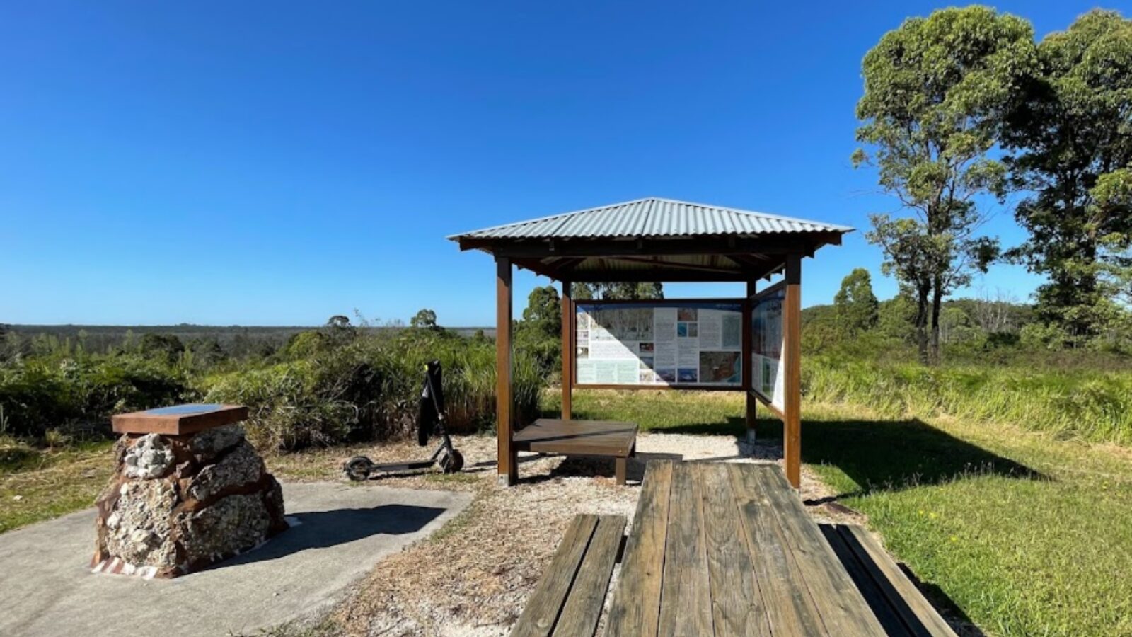
Spring Hill Lookout
Between this stop and the next you have the option of walking up to the Spring Hill Lookout that gives you 360-degree views of the surrounding landscape: the Three Brother mountains to the north; Crowdy Head to the east; and Cape Hawke at Forster to the south.
Stop 5: Saw Pit Gully
To the left of the track is Sawpit Gully where over 2,000 native trees have been planted to link remnant vegetation across the site. Revegetation and weed control has played an important role in the rehabilitation of the wetlands. Some of the weeds removed include lantana, camphor laurel, blackberry and morning glory, which has greatly assisted the natural regeneration of the wetlands.
Stop 6: Old wharf site
The trail to the north of here leads to an old wharf site on the banks of Cattai Creek, which was constructed during the mid 1800s by European settlers. The wharf was used by punts to transport selected hardwoods from Cattai to the Harrington shipyard. The circular shaped land located near the old what site is man-made, constructed for navigation purposes to assist boats in turning around.
Stop 7: Acid sulfate soils
Acid sulfate soils is the major environmental issue that the Cattai Wetlands project initially set out to address, due to the adverse impacts caused by the generation and export of acid and acid related products from the site into our waterways. Acid sulfate soil runoff can impact on water quality, aquatic ecosystems, and the productivity of our oyster and fishing industries.
The decommissioning of drains, removal of floodgates and the natural infilling of drains caused by sedimentation has helped to restore the hydrology of the site and reduce the volume of acid runoff discharging into Cattai Creek.
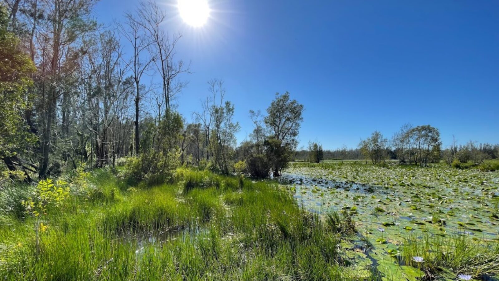
Stop 8: Two wetland types
Cattai Wetlands supports two wetland types: the perched freshwater wetland you see to your right, dominated by soft twig rush, and the tidal brackish wetland to your left, dominated by the common reed. These areas are important roosting sites for a number of endangered birds such as the jabiru (black-necked stork). Over 170 bird species have been sighted to date.
Stop 9: Endangered plant communities
Looking ahead of you on the banks of Coopernook Creek you will see a remnant of swamp sclerophyll forest which grows on flood-prone land along the coast. This plant community has been listed as endangered under state legislation due to the extensive clearing and draining of the NSW coastal floodplain. The aging timber structure is an old salt-lick shed, another reminder of Cattai's past use.
Stop 10: Strangler fig
Growing on the tree beside you is a native strangler fig, which started as a tiny seed deposited by a bird in a crevice of the tree's canopy. The seed then became a vine, which will eventually strangle and overtake the original tree upon which it began its life. When the host tree dies, the strangler fig is left behind with a lattice like hollow trunk that provides important habitat for fauna.
Stop 11: Revegetation
As you walk down the track beside Coopernook Creek take note of the trees on your right which were all planted in 2004 to replace a forest of camphor laurel that once thrived here. Camphor laurel is highly invasive, it's a declared noxious weed which spreads rapidly and out-competes native vegetation.
Stop 12: Wet eucalypt forest
The timber walking bridge crosses over a junction where the waters of the perched freshwater wetland flow into the brackish waters of Coopernook Creek. As you leave the bridge you'll notice a boardwalk on your left that leads into a wet eucalypt forest dominated by flooded gum in the lower areas and blackbutt and tallowwood on the slopes. These trees provide important koala habitat and a seasonal food source for nectar-feeding animals such as the endangered little bent-wing bat.
If you wish to explore the forest further you can either enter the Forest Loop from near the toilets, or continue along the Wetland Loop and enter it about 40m past Stop 2, which provides a gentler incline into the forest.
Download the Cattai Wetlands walks brochure here.