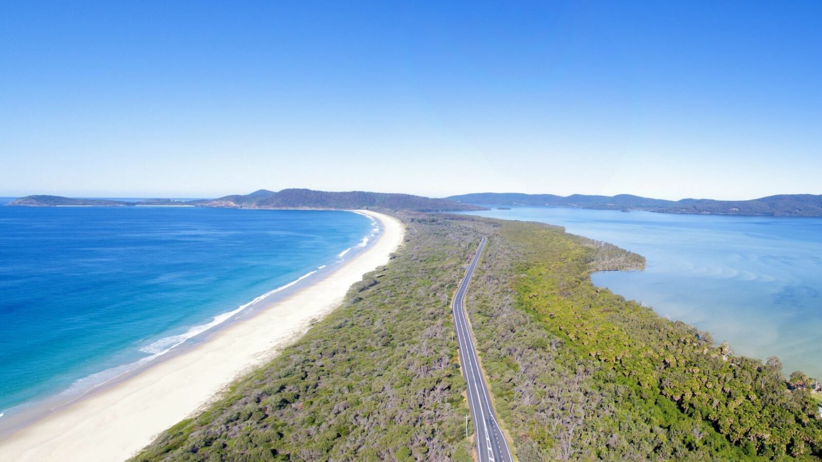
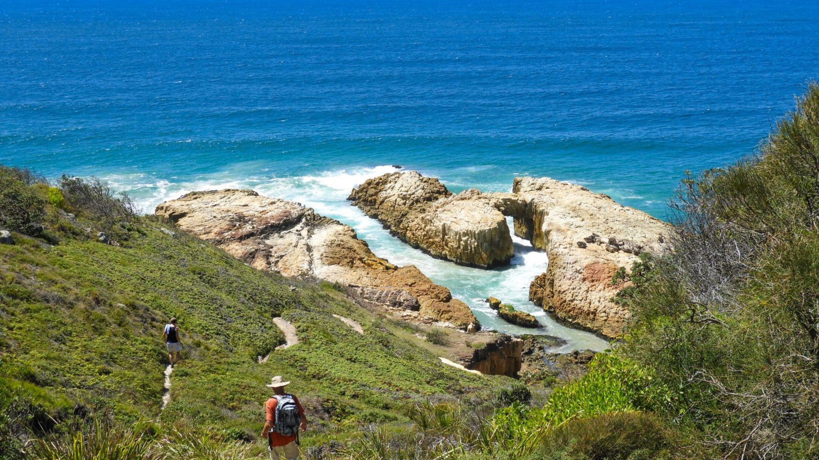
Coastal walks and deep forest hinterland walks to lookouts and waterfalls.
Curious about our best walks with lookouts, waterfalls and more?
Here are our suggestions for the top walks of the Barrington Coast - coastal and hinterland - including a few with waterfalls as reward.
Some are easy, some are a little more challenging, but you'll love them all.
Strap on those walking shoes and you'll be rewarded at every turn with something special.
And if you still want more then check out our complete list of hinterland walks, coastal walks and waterfall walks.
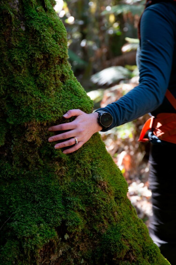
But first... shinrin-yoku
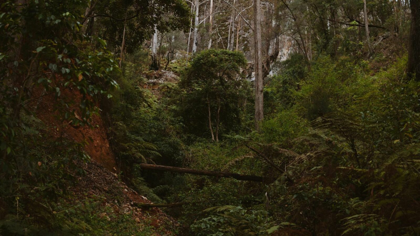
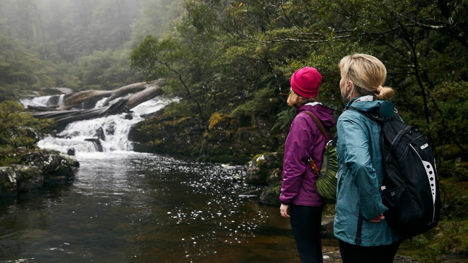
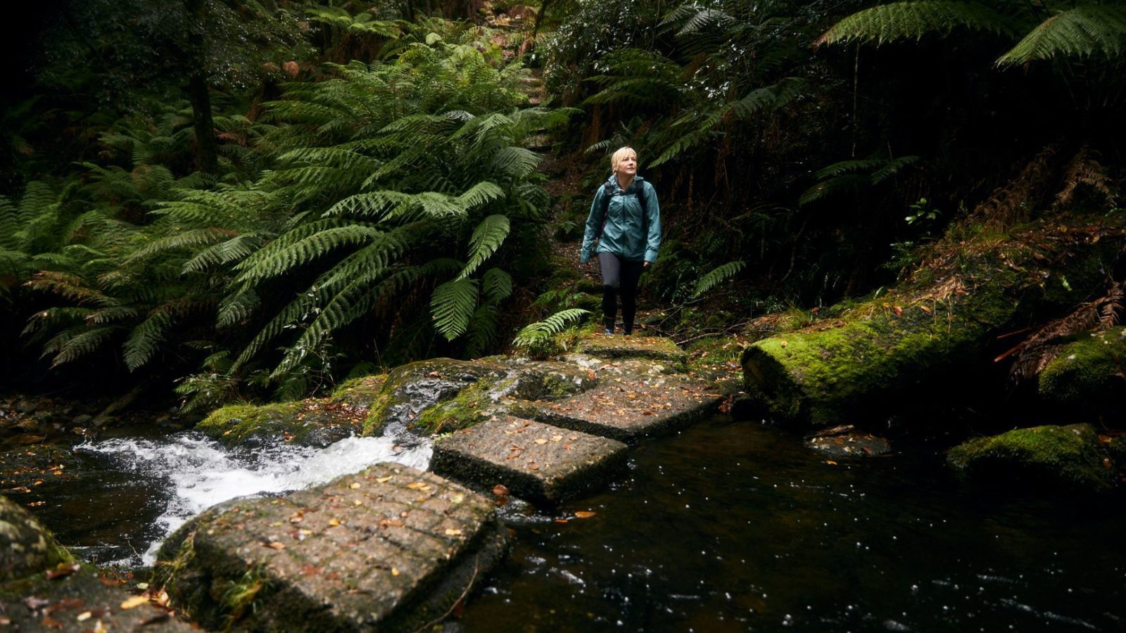
Do you feel kind of special walking through beautiful forests? The Japanese have a word for it: shinrin-yoku, which means forest bathing, or taking in the forest through your senses.
It’s not exercise or hiking or jogging. It is simply being in nature, connecting with it through our senses of sight, hearing, taste, smell and touch. Shinrin-yoku is like a bridge. By opening our senses, it bridges the gap between us and the natural world.
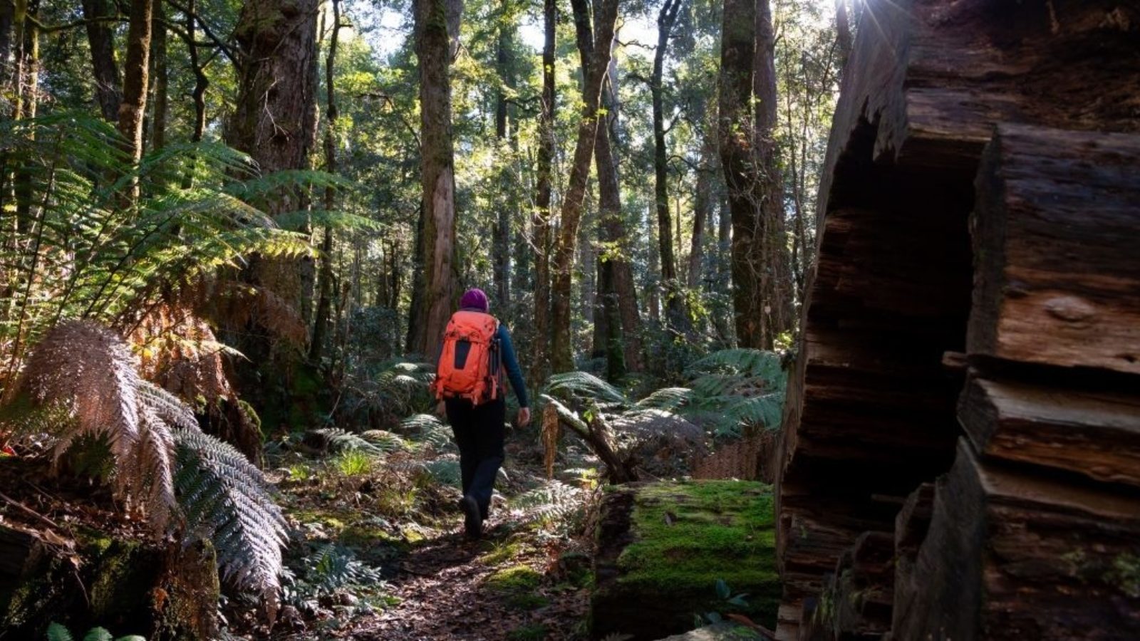
The forests of the Barrington Coast are perfect for experiencing shinrin-yoku, from the high altitude Gondwana rainforests of the Barrington Tops parklands to the coastal forests of Booti Booti, Crowdy Bay and Myall Lakes National Parks.
** Safety tip: Always check NPWS Alerts before departing for a National Park, Nature Reserve or State Conservation Area **
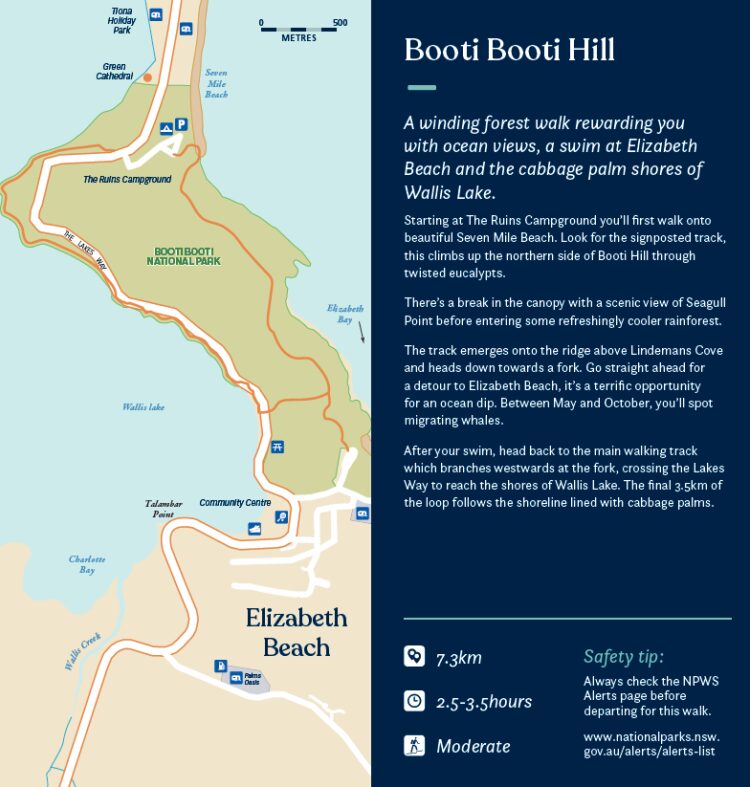
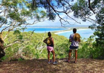
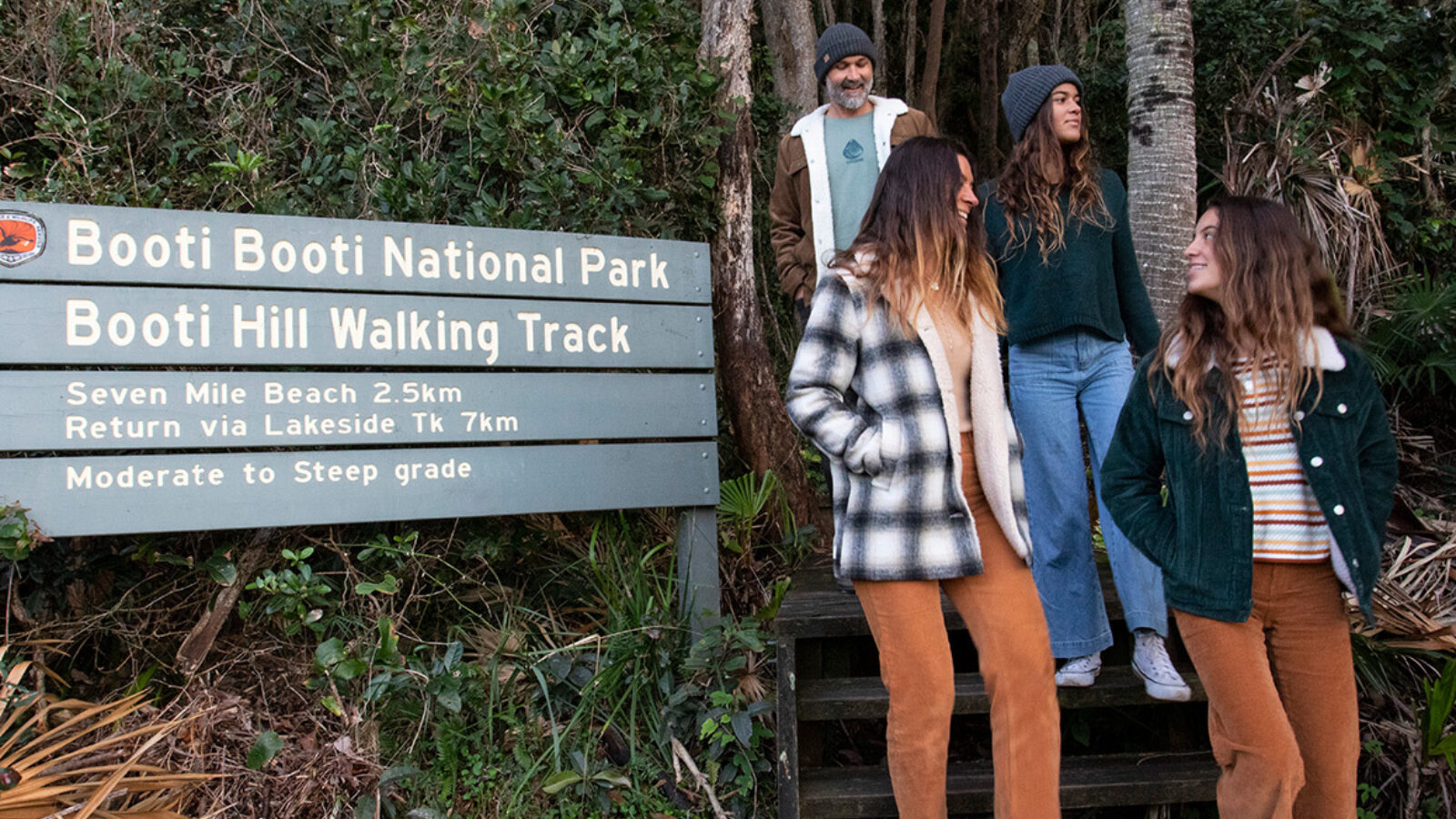
Booti Booti Hill, Pacific Palms
- 7.3km
- 2.5-3.5 hours
- Moderate
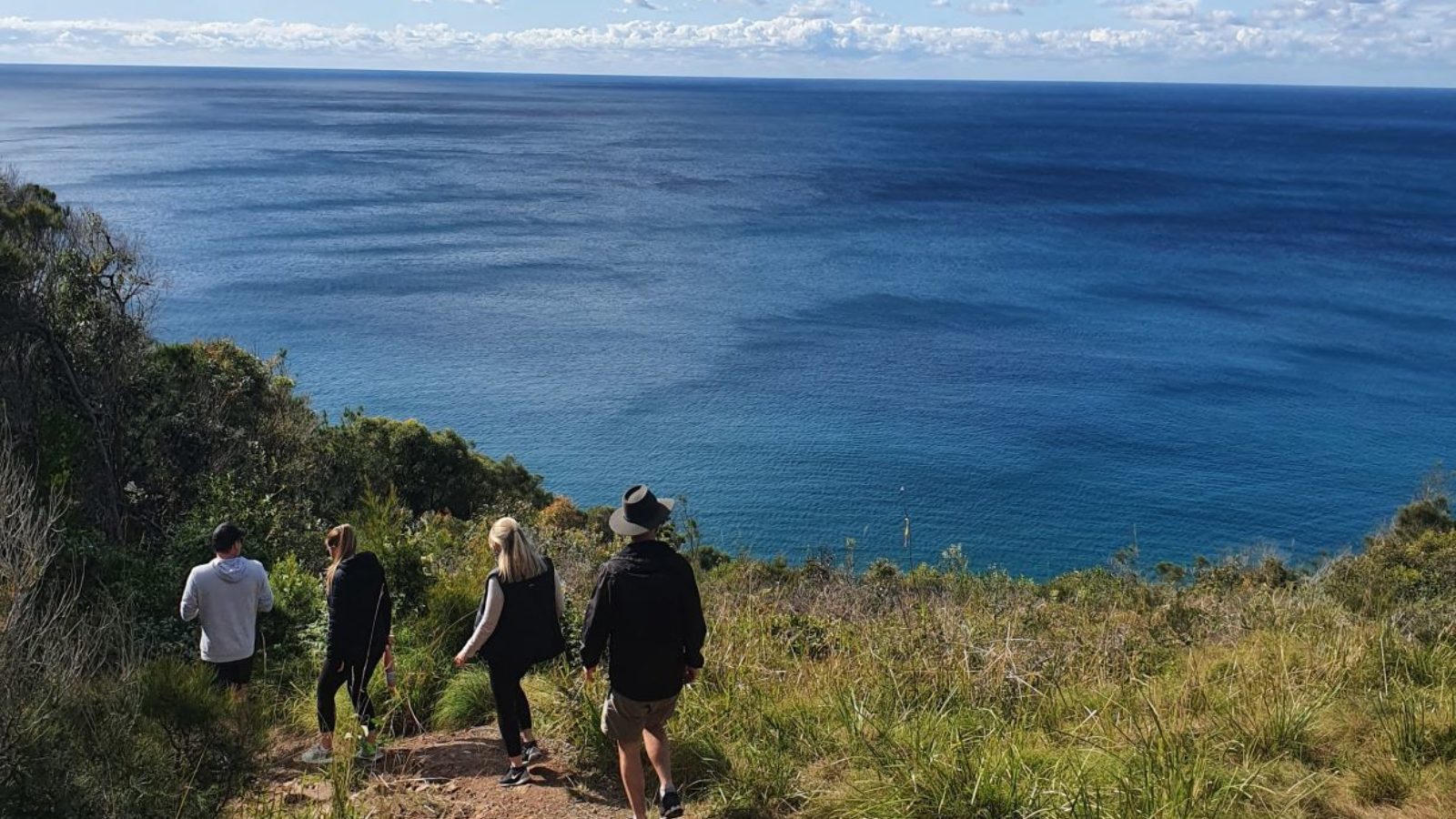
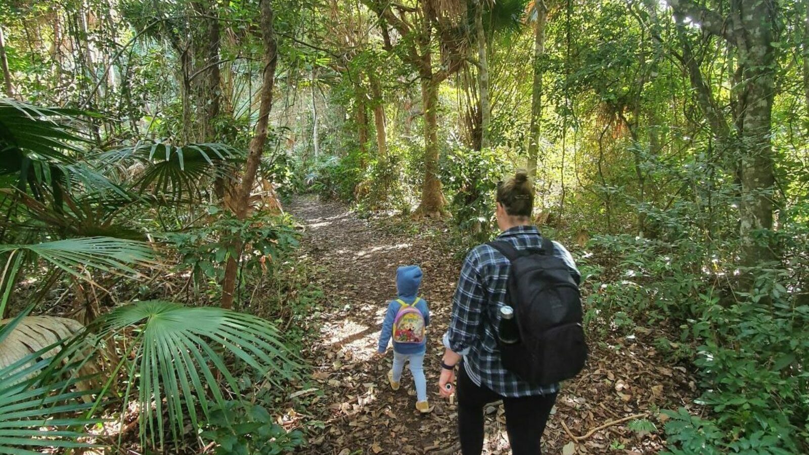
A winding forest walk rewarding you with ocean views, a swim at Elizabeth Beach and the cabbage palm shores of Wallis Lake.
Starting at The Ruins Campground you’ll first walk onto beautiful Seven Mile Beach. Look for the signposted track, this climbs up the northern side of Booti Hill through twisted eucalypts.
There’s a break in the canopy with a scenic view of Seagull Point before entering some refreshingly cooler rainforest.
The track emerges onto the ridge above Lindemans Cove and heads down towards a fork. Go straight ahead for a detour to Elizabeth Beach, it’s a terrific opportunity for an ocean dip. Between May and October, you’ll spot migrating whales.
After your swim, head back to the main walking track which branches westwards at the fork, crossing the Lakes Way to reach the shores of Wallis Lake. The final 3.5km of the loop follows the shoreline lined with cabbage palms.
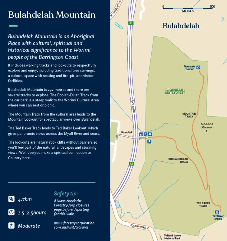
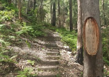
Bulahdelah Mountain
- 4.7km
- 1.5-2.5 hours
- Moderate
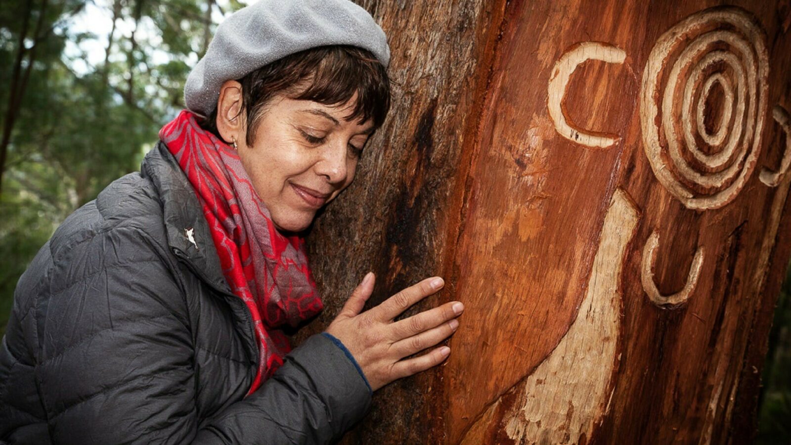
Bulahdelah Mountain is an Aboriginal Place with cultural, spiritual and historical significance to the Worimi people of the Barrington Coast.
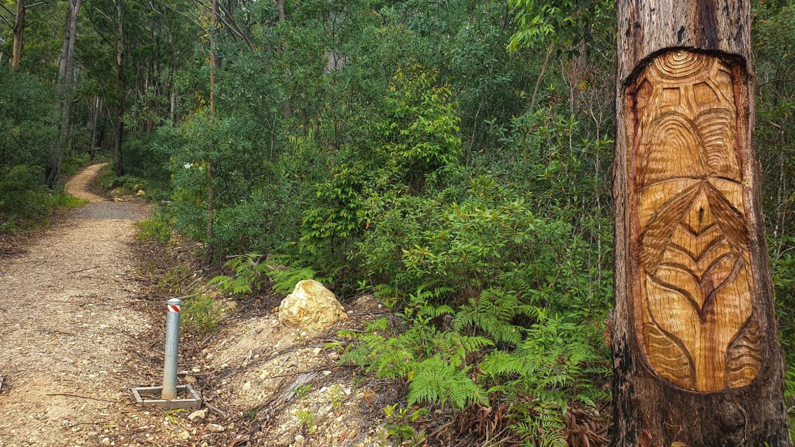
It includes walking tracks and lookouts to respectfully explore and enjoy, including traditional tree carvings, a cultural space with seating and fire-pit, and visitor facilities.
Bulahdelah Mountain is 292 metres and there are several tracks to explore. The Boolah-Dillah Track from the car park is a steep walk to the Worimi Cultural Area where you can rest or picnic.
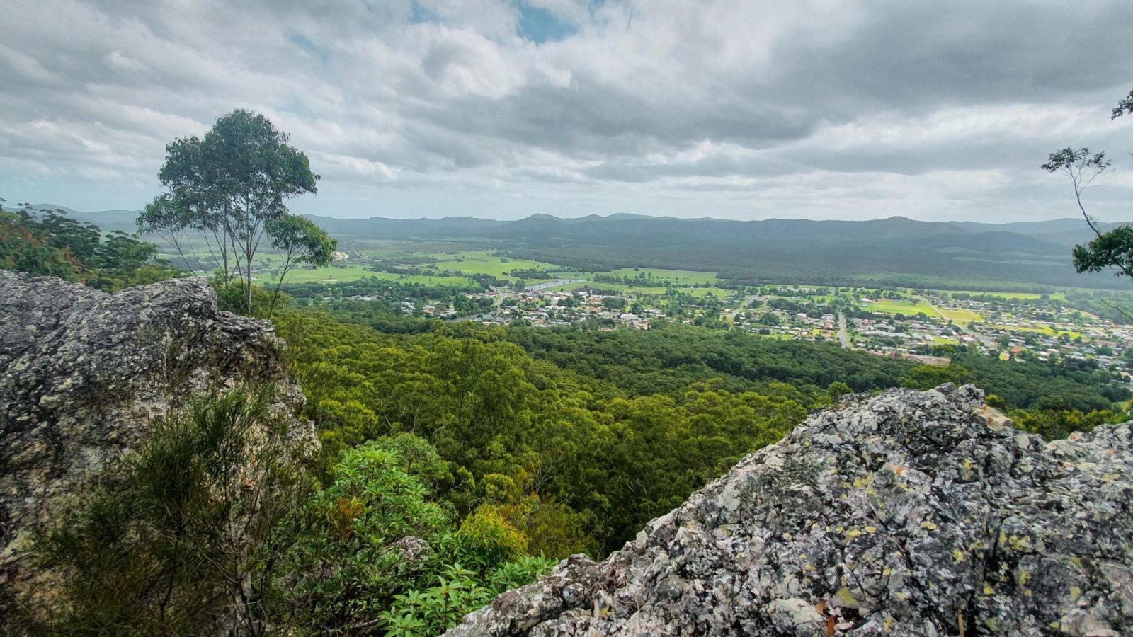
The Mountain Track from the cultural area leads to the Mountain Lookout for spectacular views over Bulahdelah.
The Ted Baker Track leads to Ted Baker Lookout, which gives panoramic views across the Myall River and coast.
The lookouts are natural rock cliffs without barriers so you’ll feel part of the natural landscapes and stunning views. We hope you make a spiritual connection to Country here.
** Safety tip: Always check ForestryCorp closures before departing for this state forest walk **
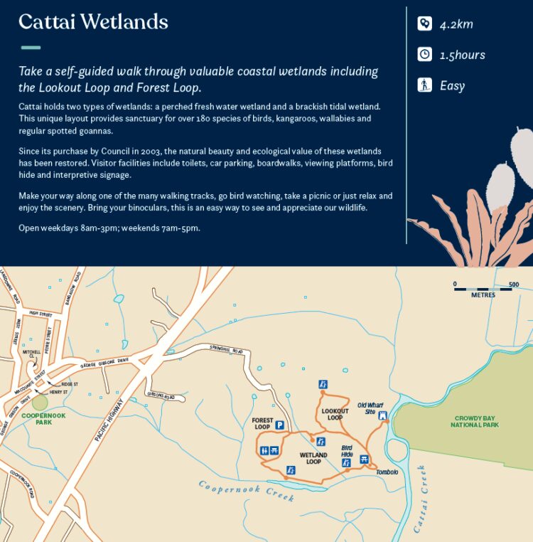
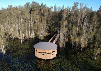
Cattai Wetlands, Coopernook
- 4.2km
- 1.5 hours
- Easy
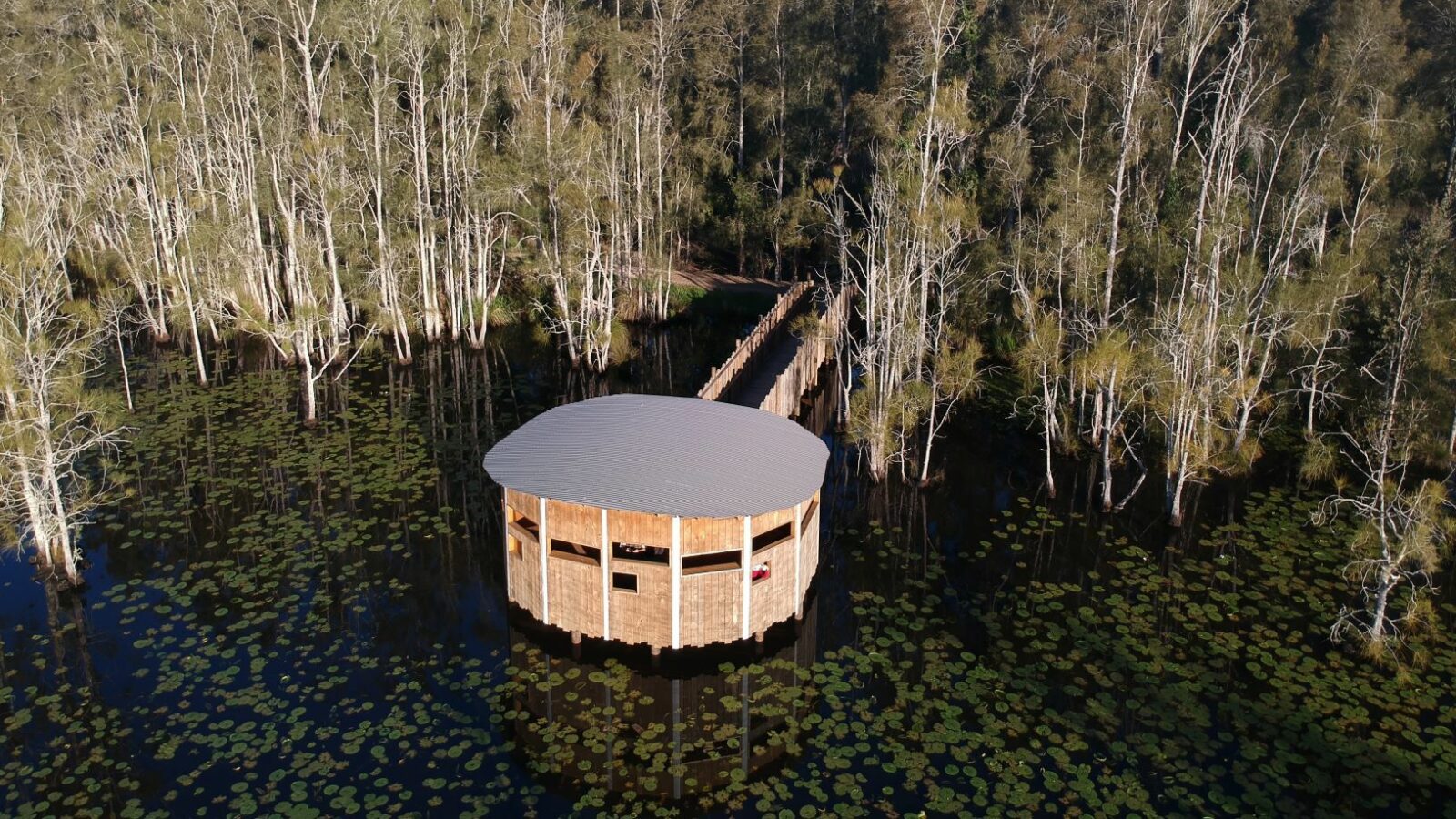
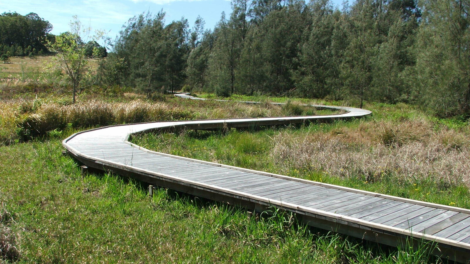
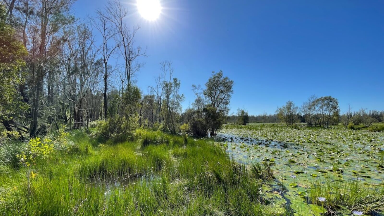
Not far from the broad sands of Harrington is Cattai Wetlands, a naturalist's delight.
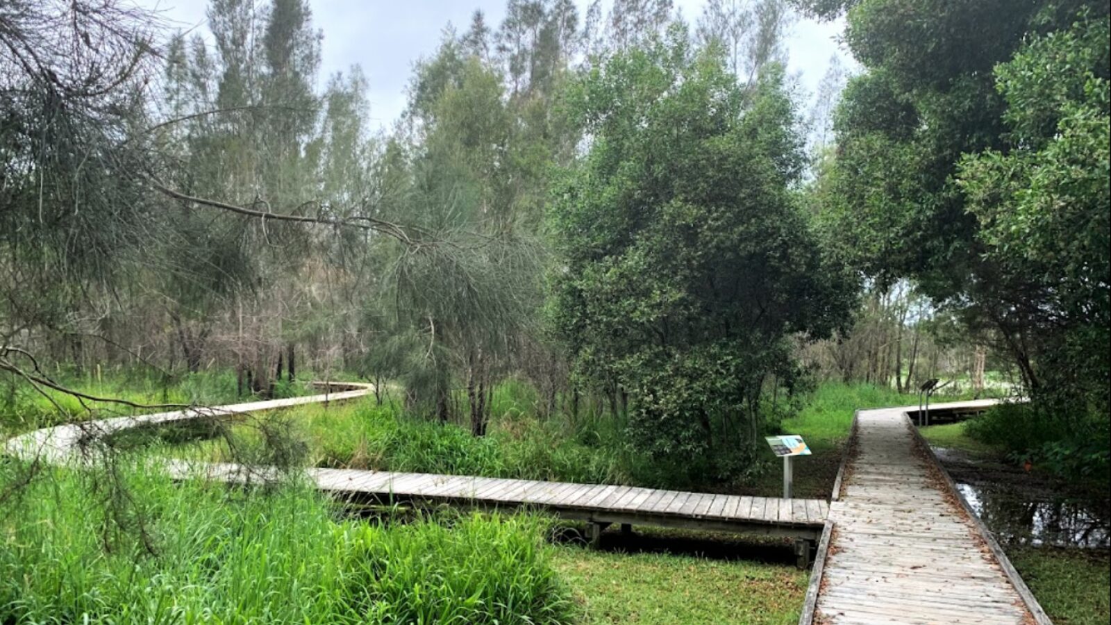
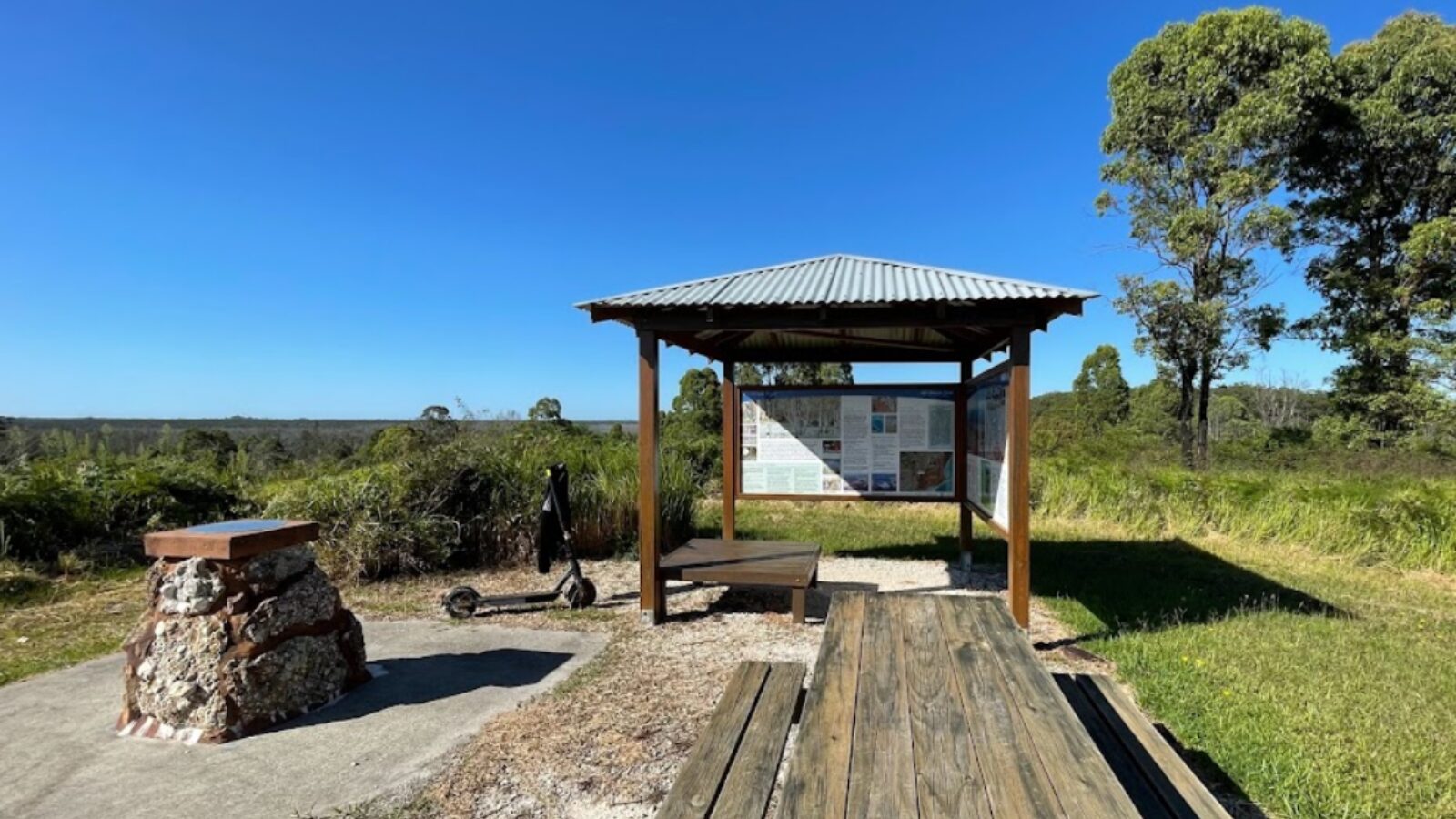
Take a self-guided walk through these valuable coastal wetlands including the Lookout Loop and Forest Loop.
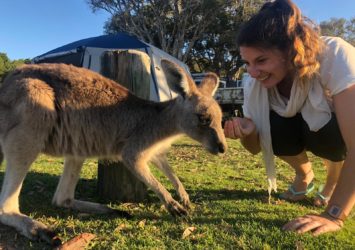
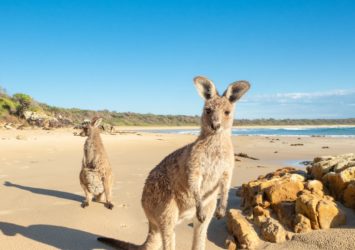
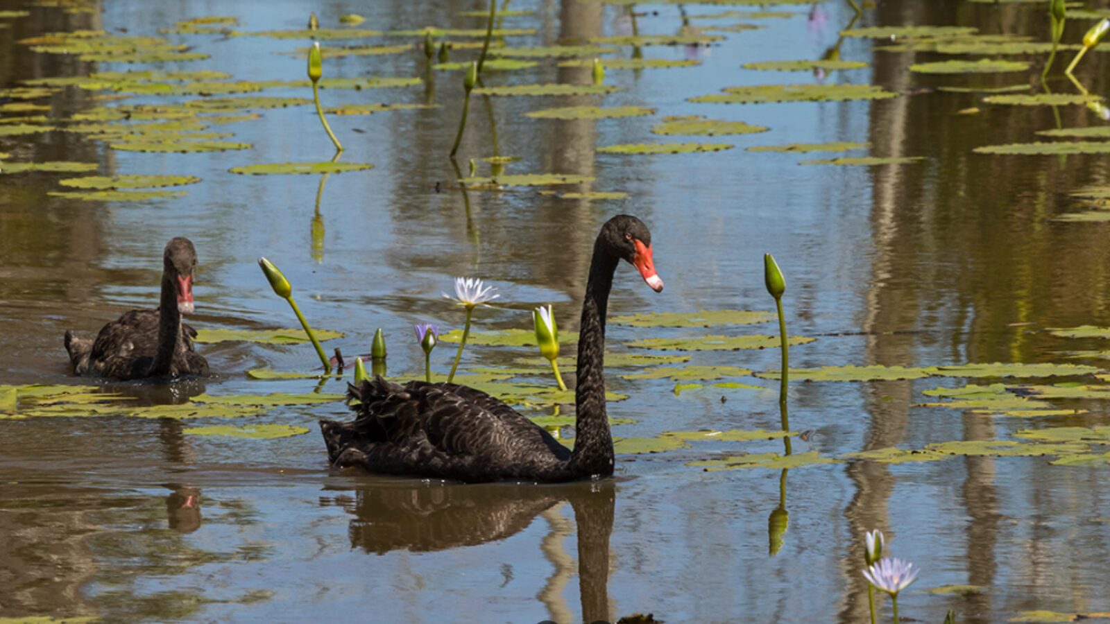
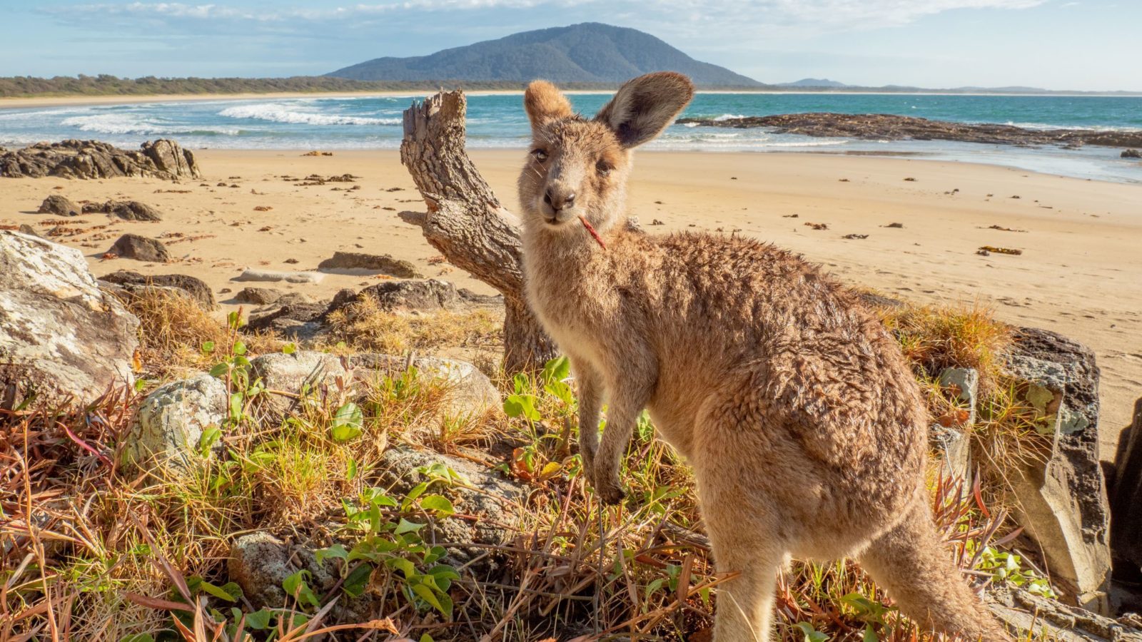
Cattai holds two types of wetlands: a perched fresh water wetland and a brackish tidal wetland. This unique layout provides sanctuary for over 180 species of birds, kangaroos, wallabies and regular spotted goannas.
Since its purchase by Council in 2003, the natural beauty and ecological value of these wetlands has been restored. Visitor facilities include toilets, car parking, boardwalks, viewing platforms, bird hide and interpretive signage.
Make your way along one of the many walking tracks, go bird watching, take a picnic or just relax and enjoy the scenery. Bring your binoculars, this is an easy way to see and appreciate our wildlife.
Open weekdays 8am-3pm; weekends 7am-5pm.
Diamond Head, Crowdy Bay
- 4.3km
- 1.5-2.5 hours
- Moderate
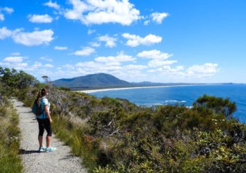
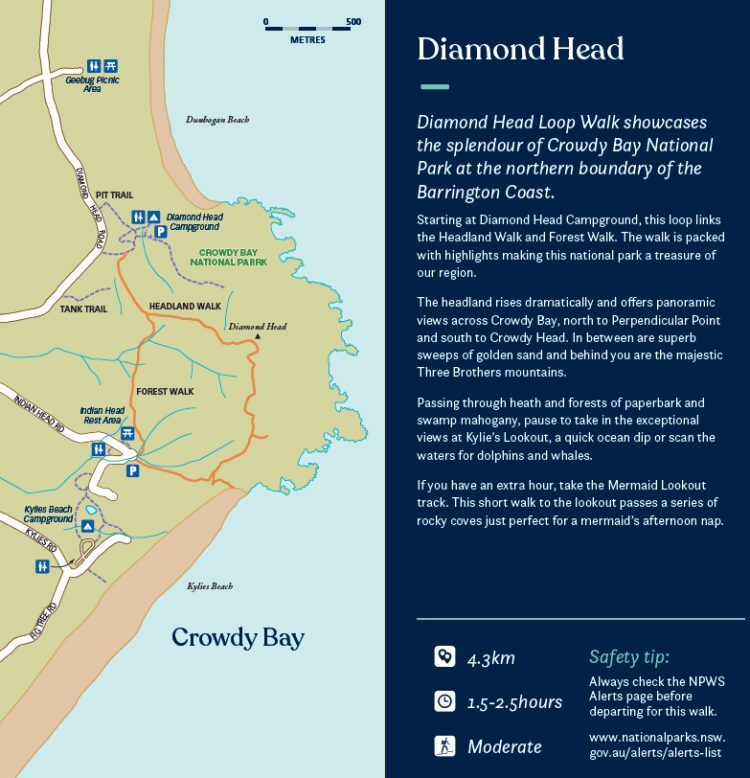
Diamond Head Loop Walk showcases the splendour of Crowdy Bay National Park at the northern boundary of the Barrington Coast.
Starting at Diamond Head Campground, this loop links the Headland Walk and Forest Walk. The walk is packed with highlights making this national park a treasure of our region.
The headland rises dramatically and offers panoramic views across Crowdy Bay, north to Perpendicular Point and south to Crowdy Head. In between are superb sweeps of golden sand and behind you are the majestic Three Brothers mountains.
Passing through heath and forests of paperbark and swamp mahogany, pause to take in the exceptional views at Kylie’s Lookout, a quick ocean dip or scan the waters for dolphins and whales.
If you have an extra hour, take the Mermaid Lookout track. This short walk to the lookout passes a series of rocky coves just perfect for a mermaid’s afternoon nap.
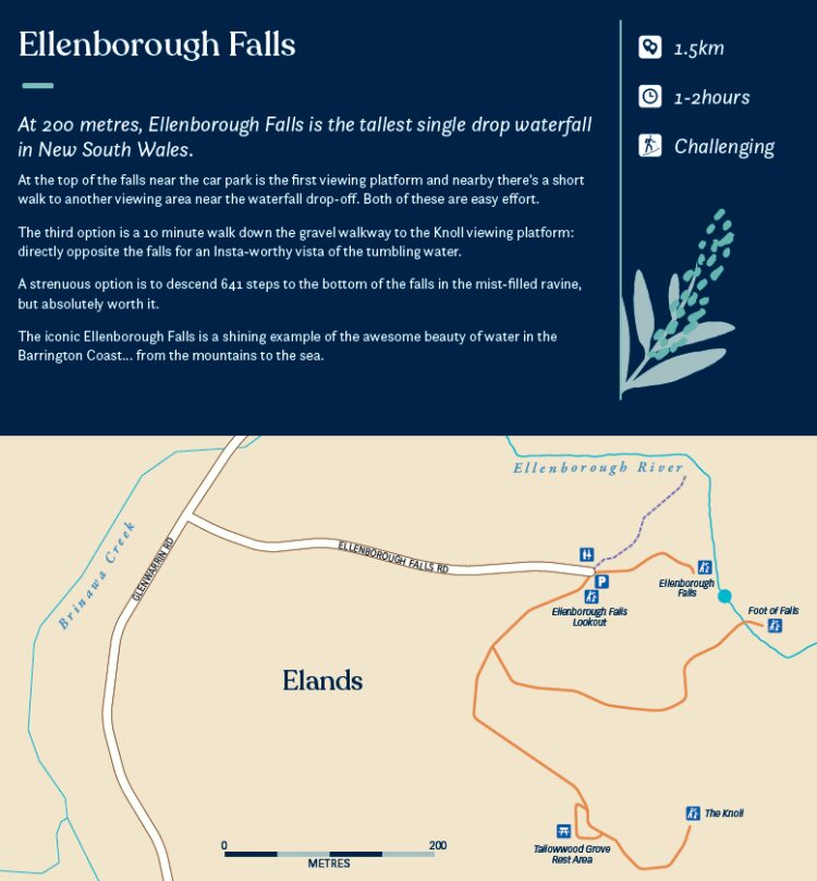
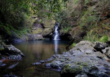
Ellenborough Falls, Elands
- 1.5km with 641 steps
- 1-2 hours
- Challenging
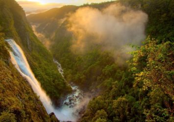
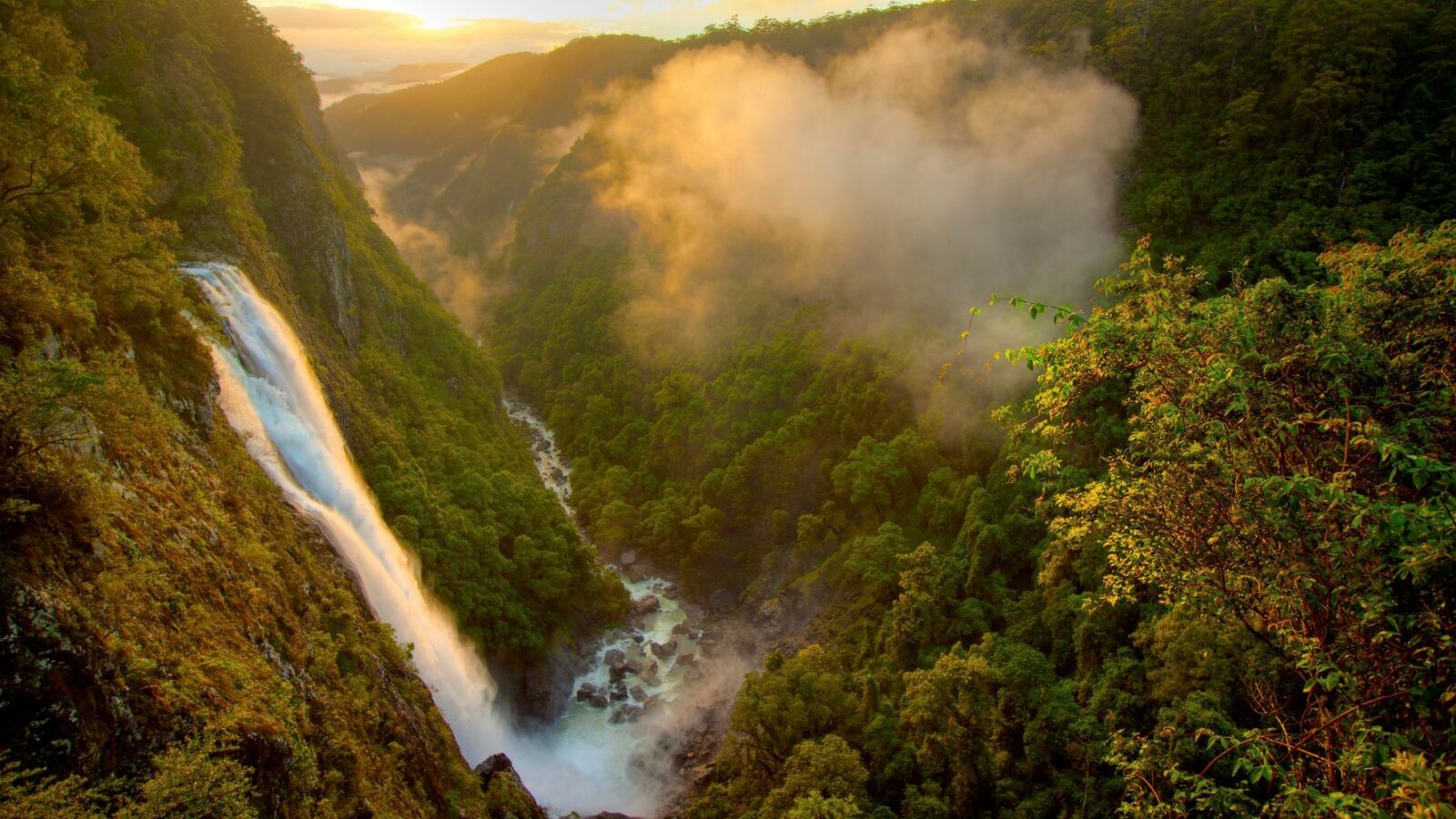
At 200 metres, Ellenborough Falls is the tallest single drop waterfall in New South Wales.
At the top of the falls near the car park is the first viewing platform and nearby there's a short walk to another viewing area near the waterfall drop-off. Both of these are easy effort.
The third option is a 10 minute walk down the gravel walkway to the Knoll viewing platform: directly opposite the falls for an Insta-worthy vista of the tumbling water.
A strenuous option is to descend 641 steps to the bottom of the falls in the mist-filled ravine, but absolutely worth it.
The iconic Ellenborough Falls is a shining example of the awesome beauty of water in the Barrington Coast… from the mountains to the sea.
Caution: Take extreme care if you choose to swim in the rocky pool at the bottom of the falls.
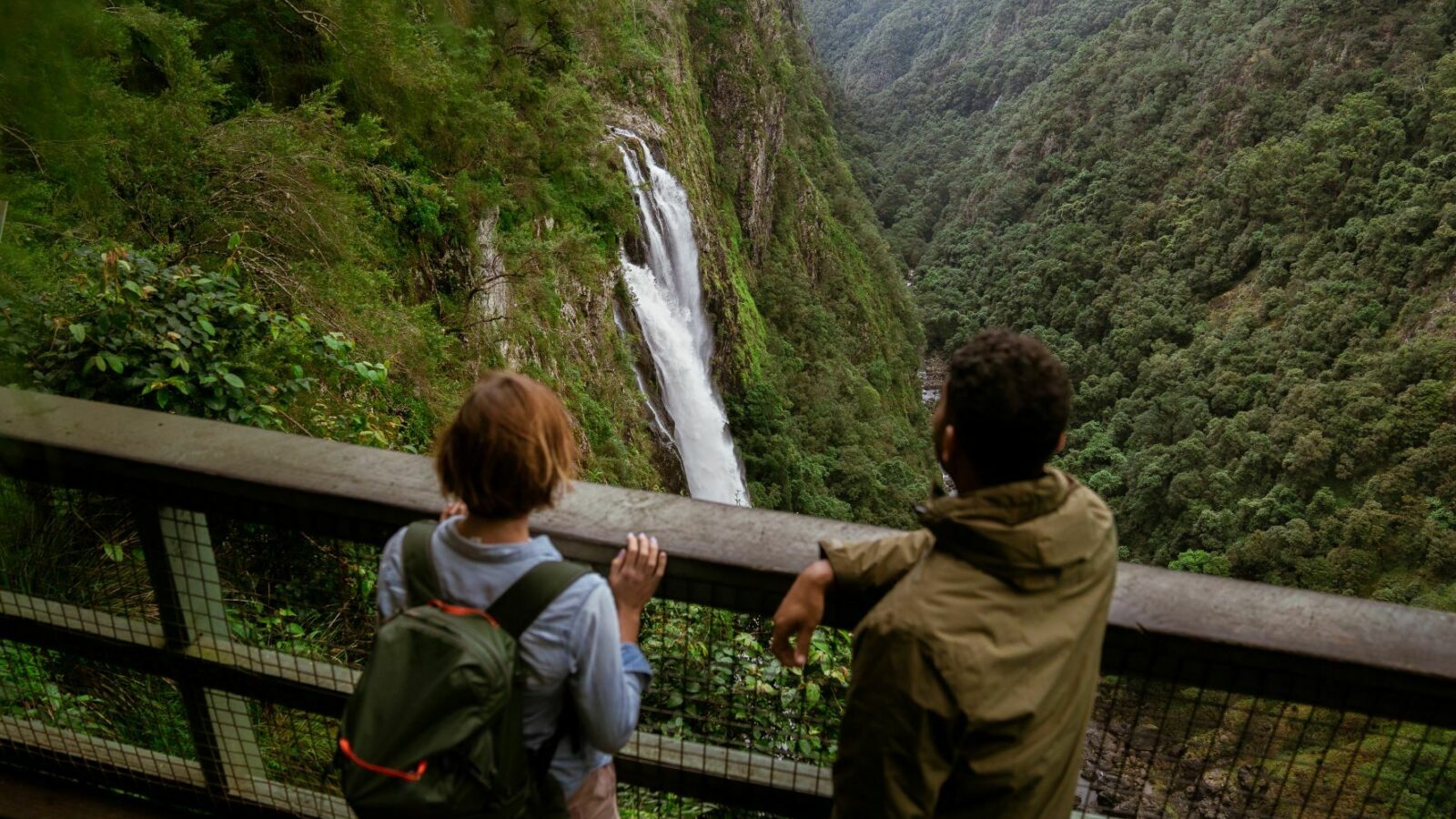
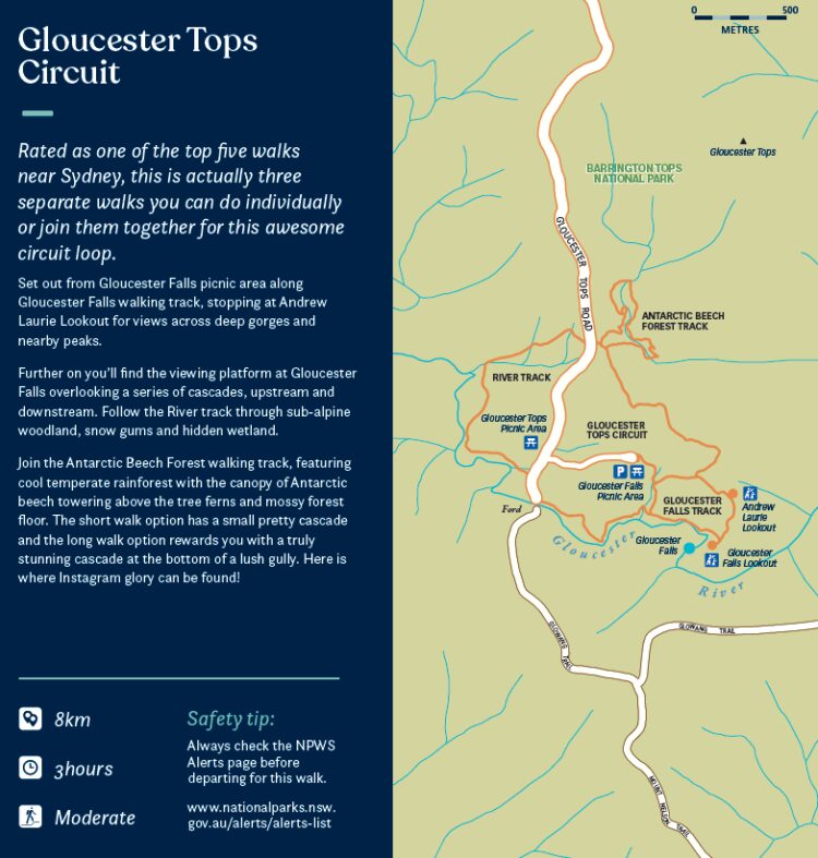
Gloucester Falls and Gloucester Tops Circuit, Barrington Tops
- 8km
- 3 hours
- Moderate
This is rated as one of the top five walks near Sydney, so you really shouldn't miss seeing it.
It's actually three separate walks you can do individually or join them together for this awesome circuit loop.
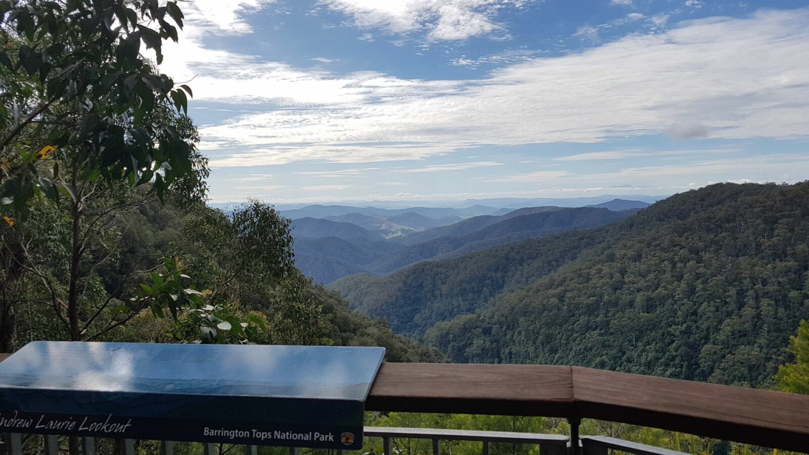
Set out from Gloucester Falls picnic area along Gloucester Falls walking track, stopping at Andrew Laurie Lookout for views across deep gorges and nearby peaks.
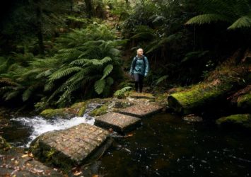
Further on you’ll find the viewing platform at Gloucester Falls overlooking a series of cascades, upstream and downstream. Follow the River track through sub-alpine woodland, snow gums and hidden wetland.
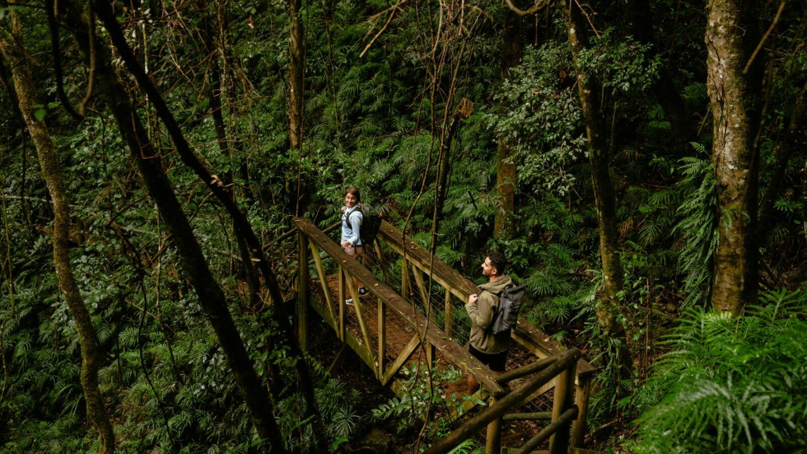
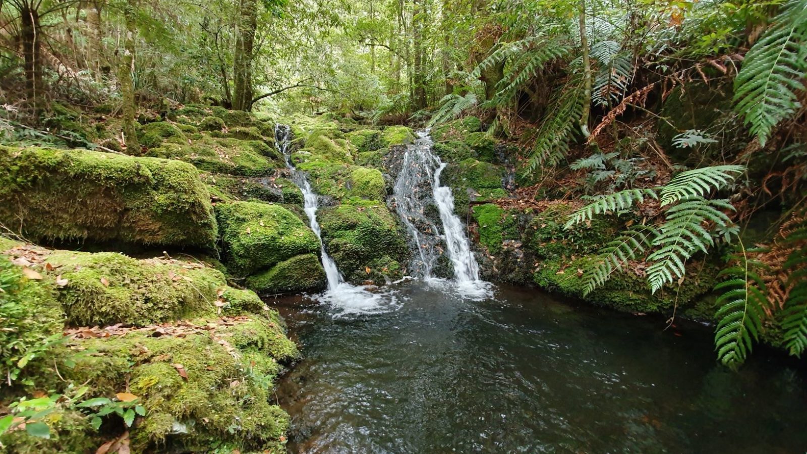
Join the Antarctic Beech Forest walking track, featuring cool temperate rainforest with the canopy of Antarctic beech towering above the tree ferns and mossy forest floor. The short walk option has a small pretty cascade and the long walk option rewards you with a truly stunning cascade at the bottom of a lush gully. Here is where Instagram glory can be found!
If you're heading to Barrington Tops the best approach is via Gloucester on the eastern side, stop for fuel, provisions, a coffee or a meal on your way through.
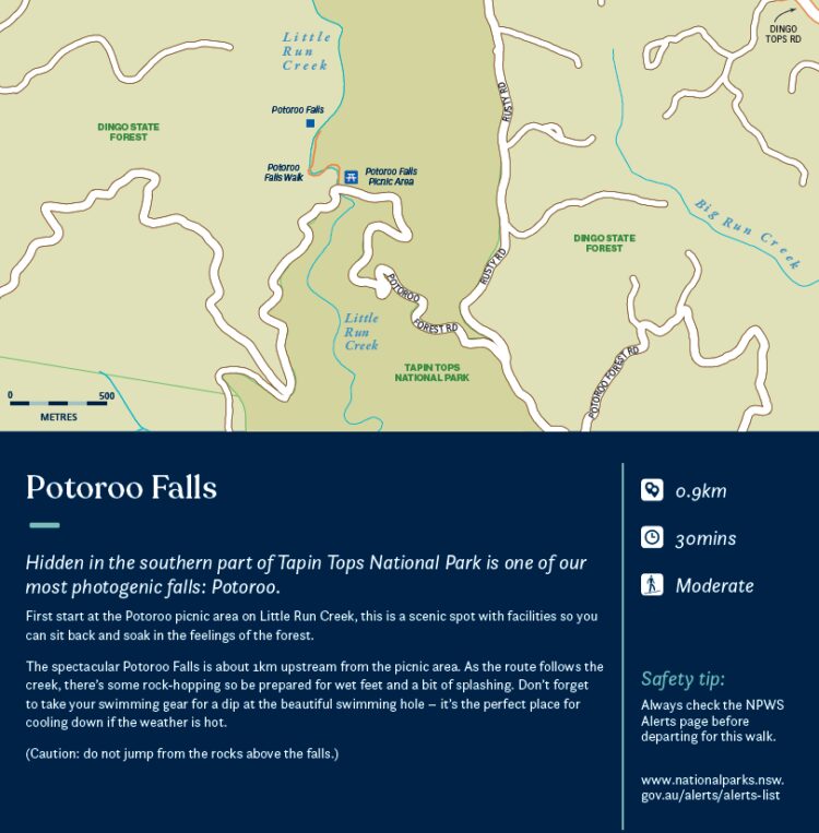
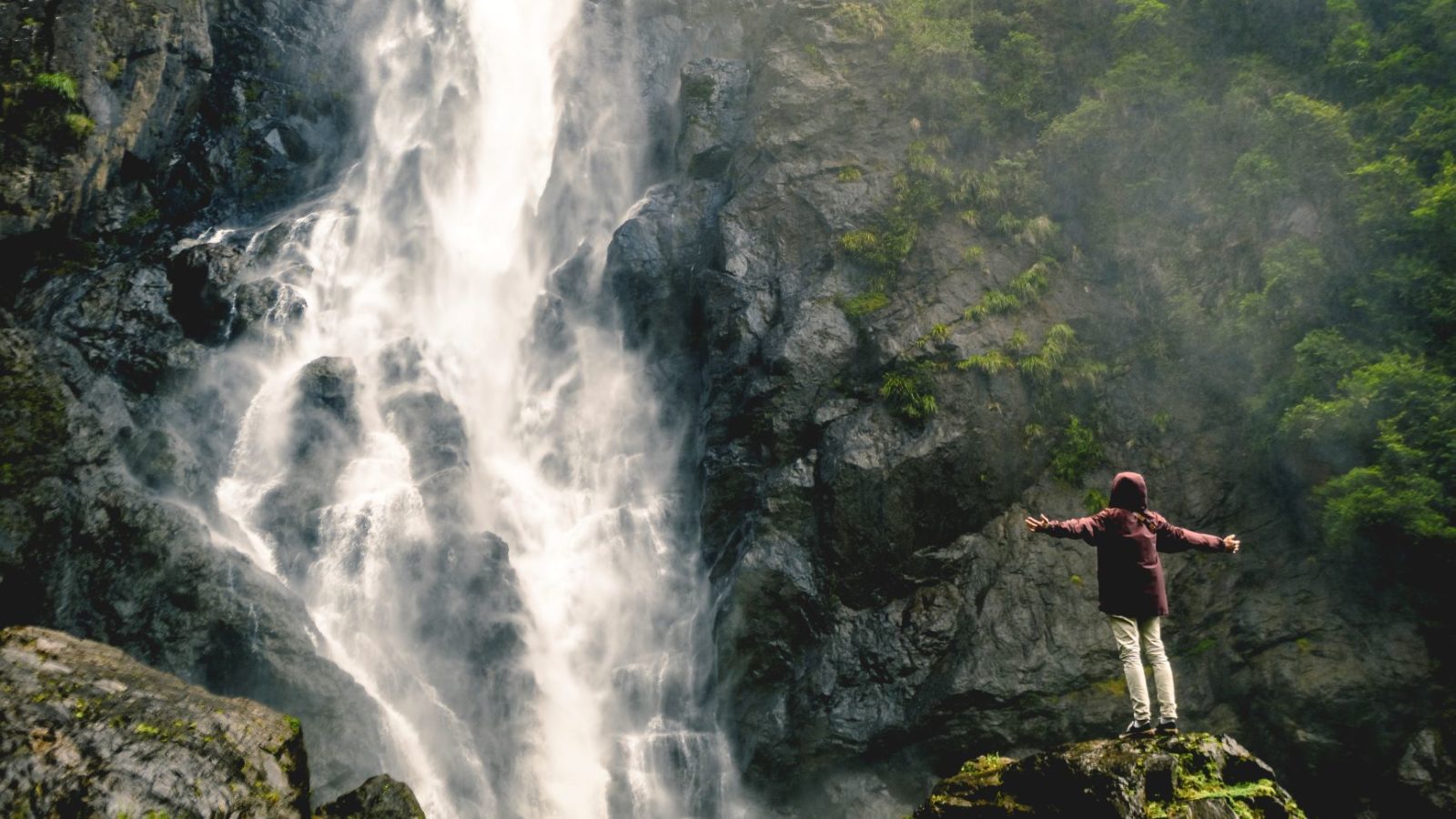
Potoroo Falls, Tapin Tops
- 0.9km
- 30 minutes
- Moderate
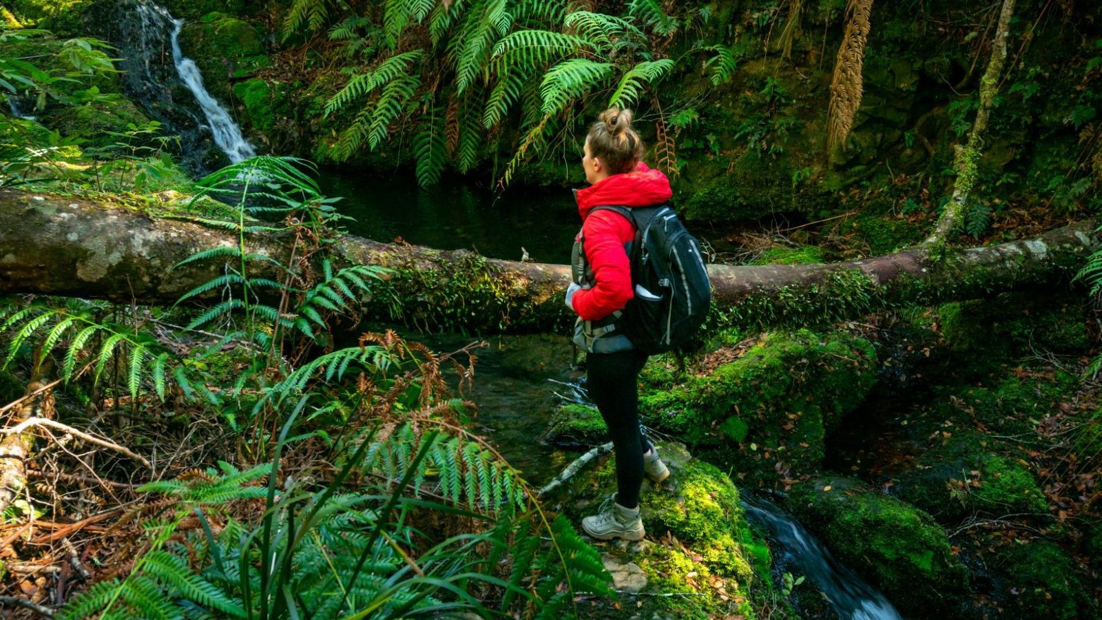
Hidden in the southern part of Tapin Tops National Park is one of our most photogenic falls: Potoroo.
First start at the Potoroo picnic area on Little Run Creek, this is a scenic spot with facilities so you can sit back and soak in the feelings of the forest.
The spectacular Potoroo Falls is about 1km upstream from the picnic area. As the route follows the creek, there’s some rock-hopping so be prepared for wet feet and a bit of splashing. Don’t forget to take your swimming gear for a dip at the beautiful swimming hole – it’s the perfect place for cooling down if the weather is hot.
Caution: do not jump from the rocks above the falls.
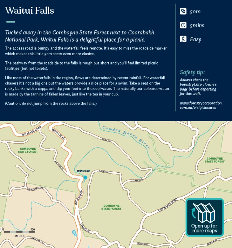
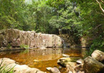
Waitui Falls
- 50m
- 5 minutes
- Easy
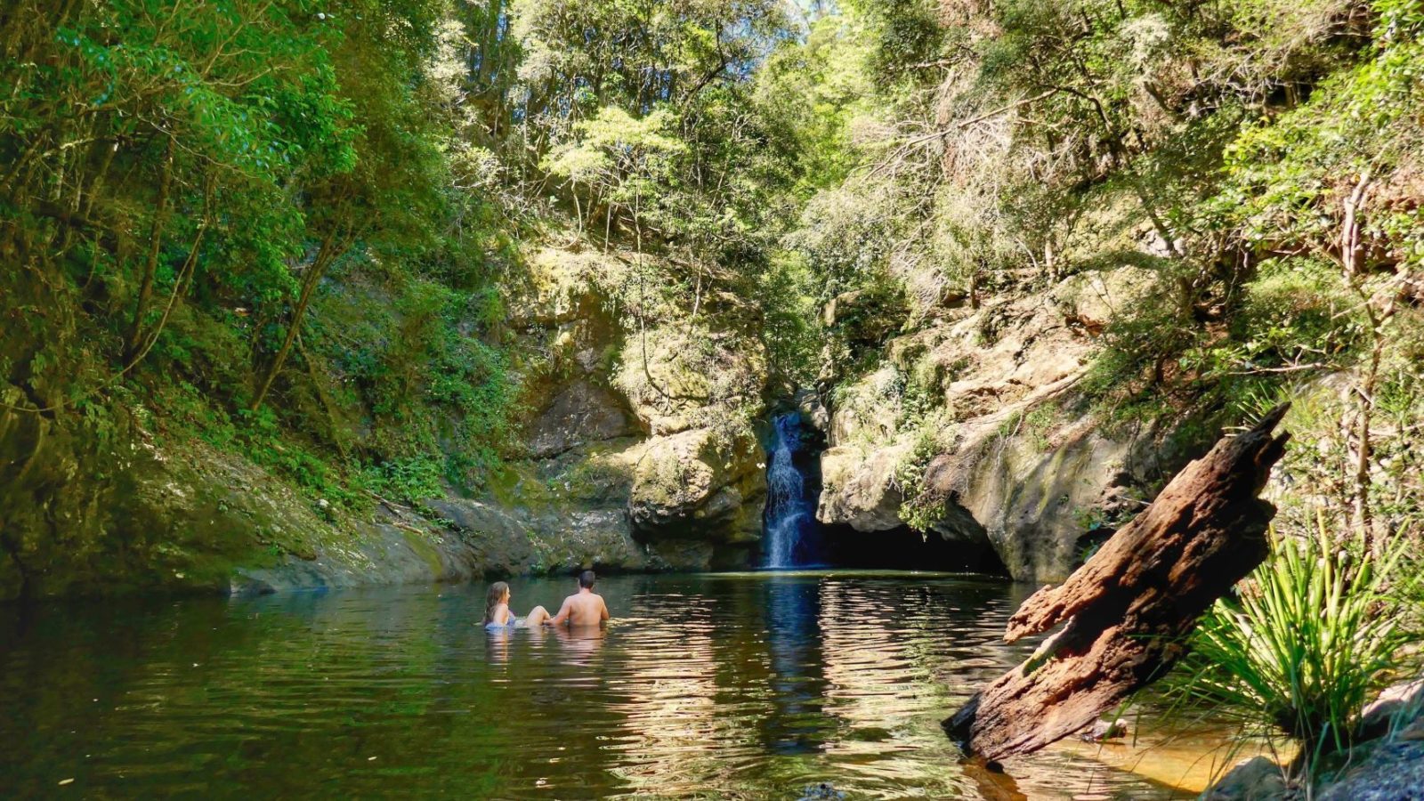
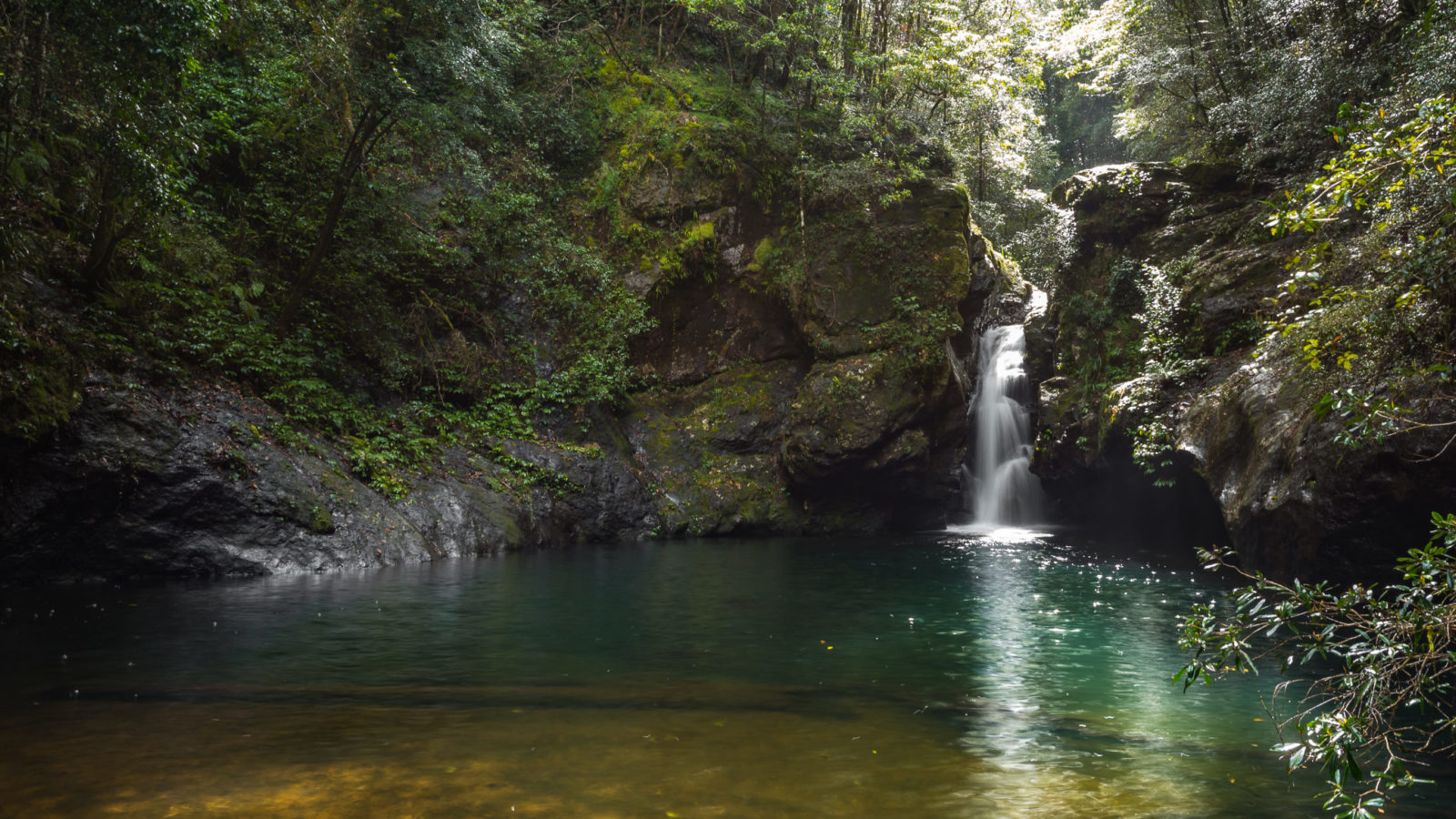
Tucked away in the Comboyne State Forest next to Coorabakh National Park, Waitui Falls is a delightful place for a picnic.
The access road is bumpy and the waterfall feels remote. It’s easy to miss the roadside marker which makes this little gem seem even more elusive.
The pathway from the roadside to the falls is rough but short and you’ll find limited picnic facilities (but not toilets).
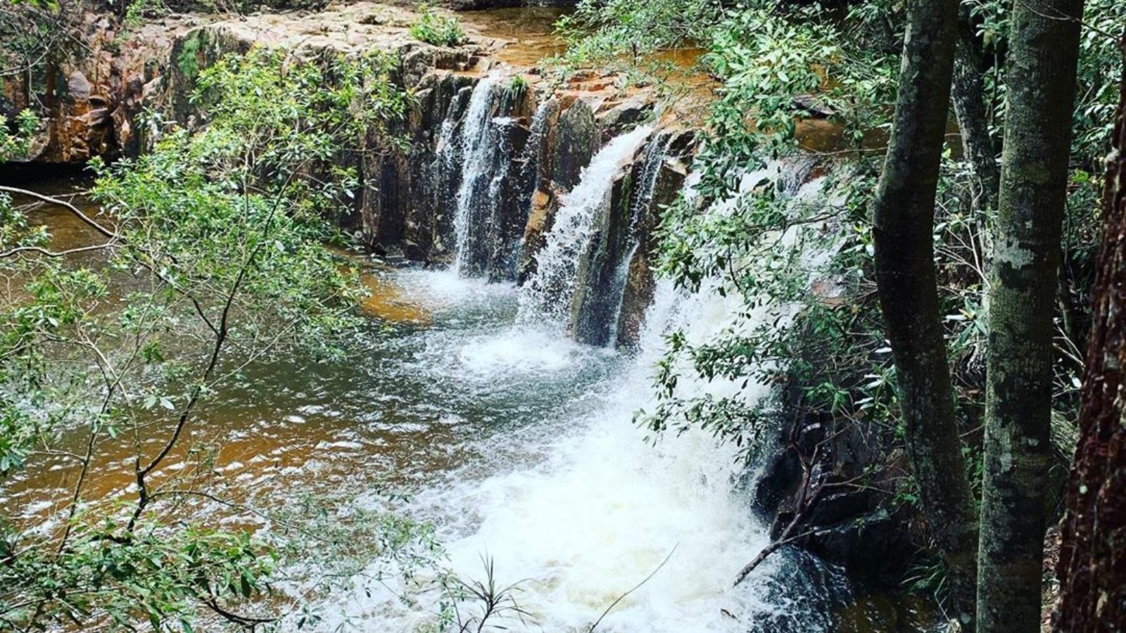
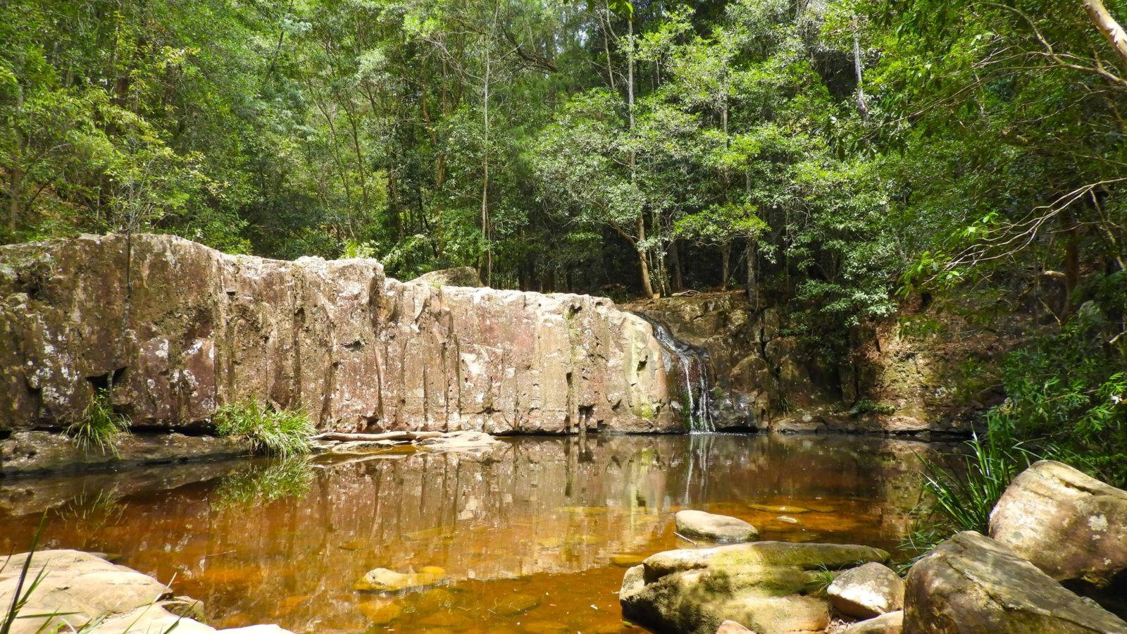
Like most of the waterfalls in the region, flows are determined by recent rainfall. For waterfall chasers it’s not a big one but the waters provide a nice place for a swim. Take a seat on the rocky banks with a cuppa and dip your feet into the cool water. The naturally tea-coloured water is made by the tannins of fallen leaves, just like the tea in your cup.
Caution: do not jump from the rocks above the falls.
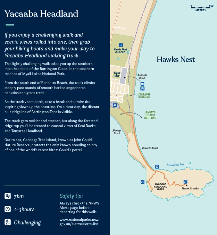
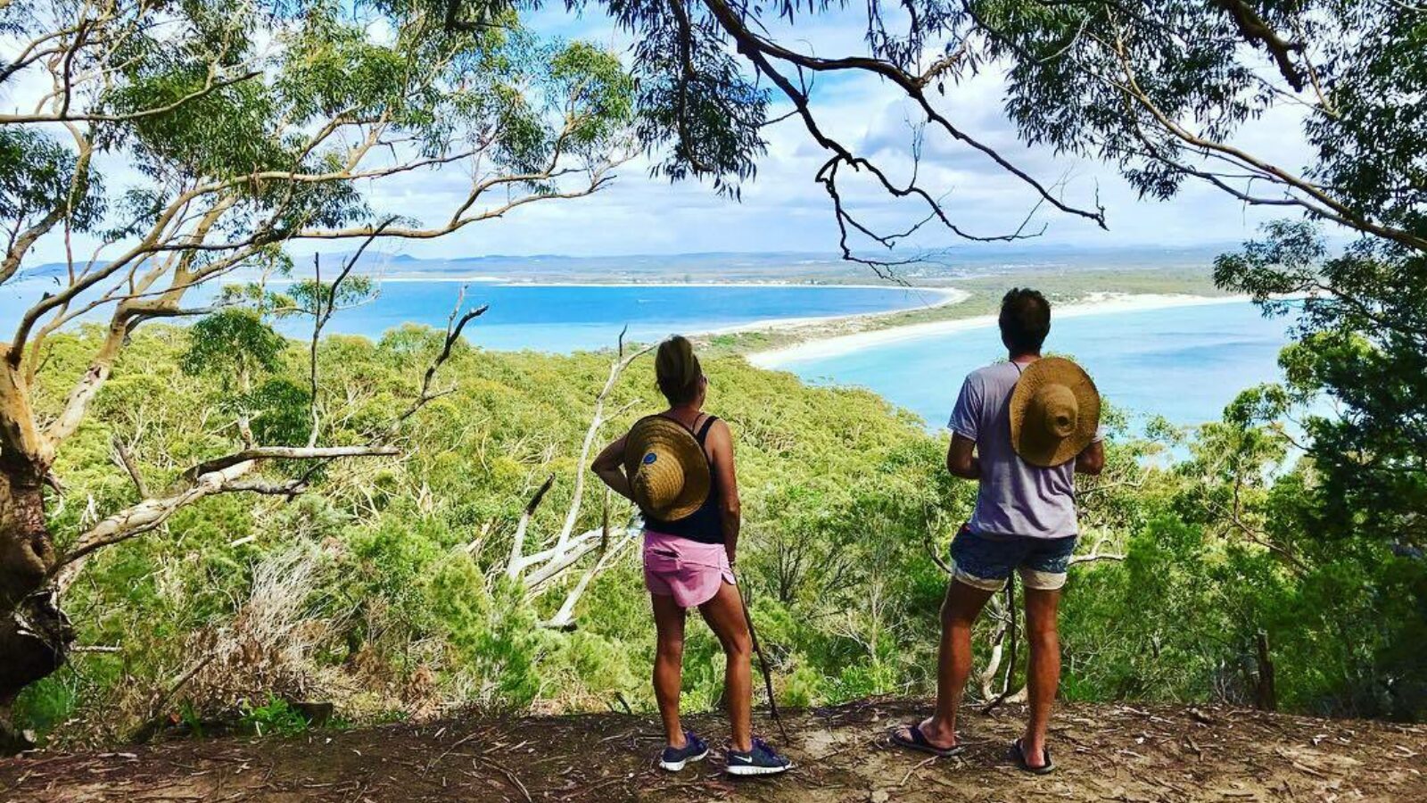
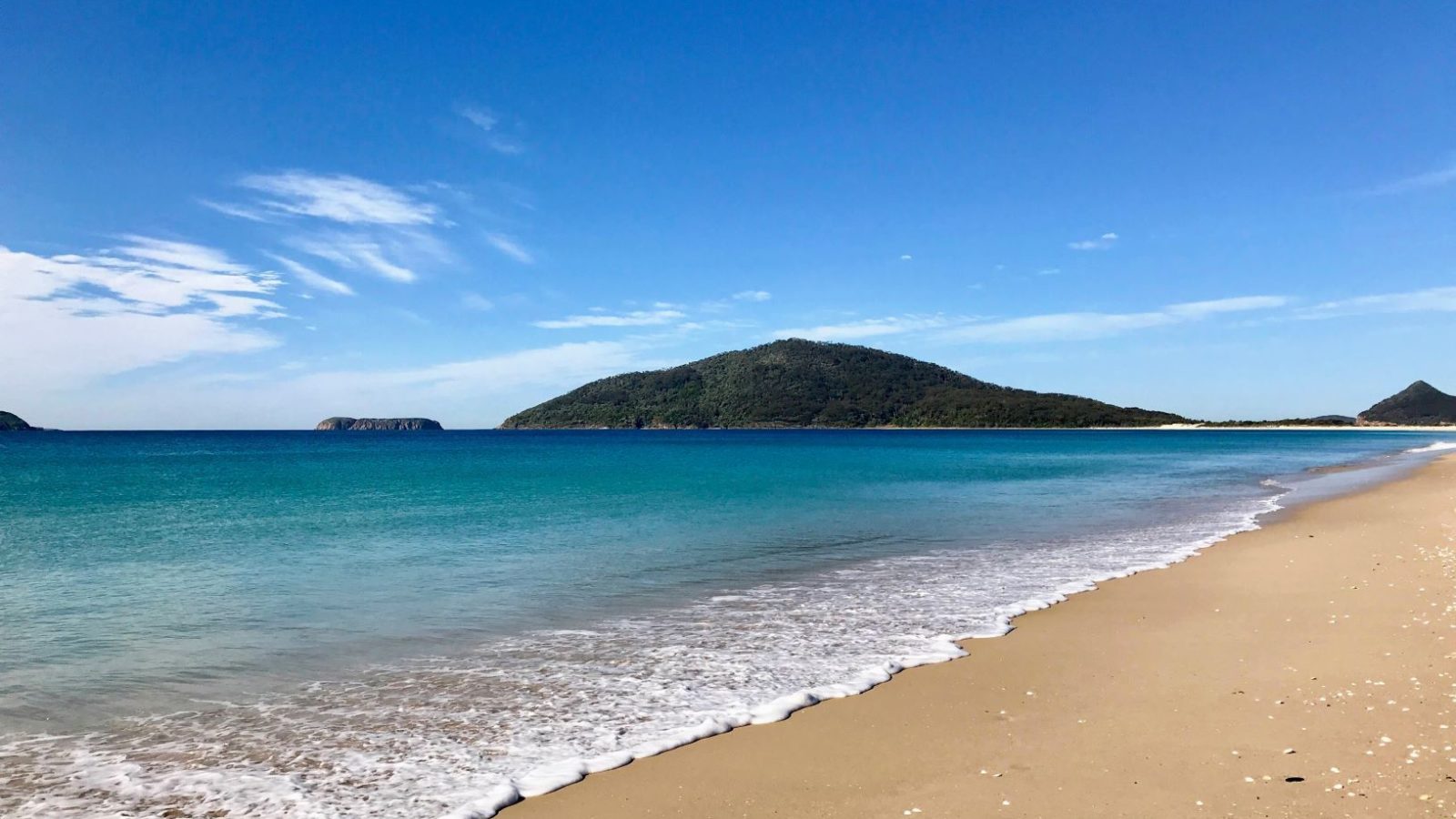
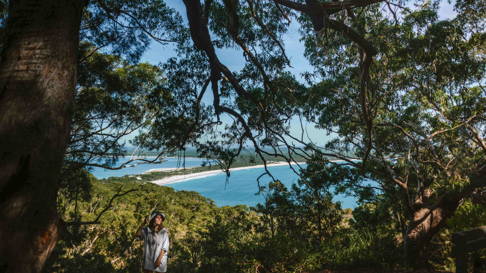
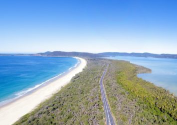
Yacaaba Headland
- 7km
- 2-3 hours
- Challenging
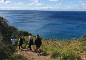
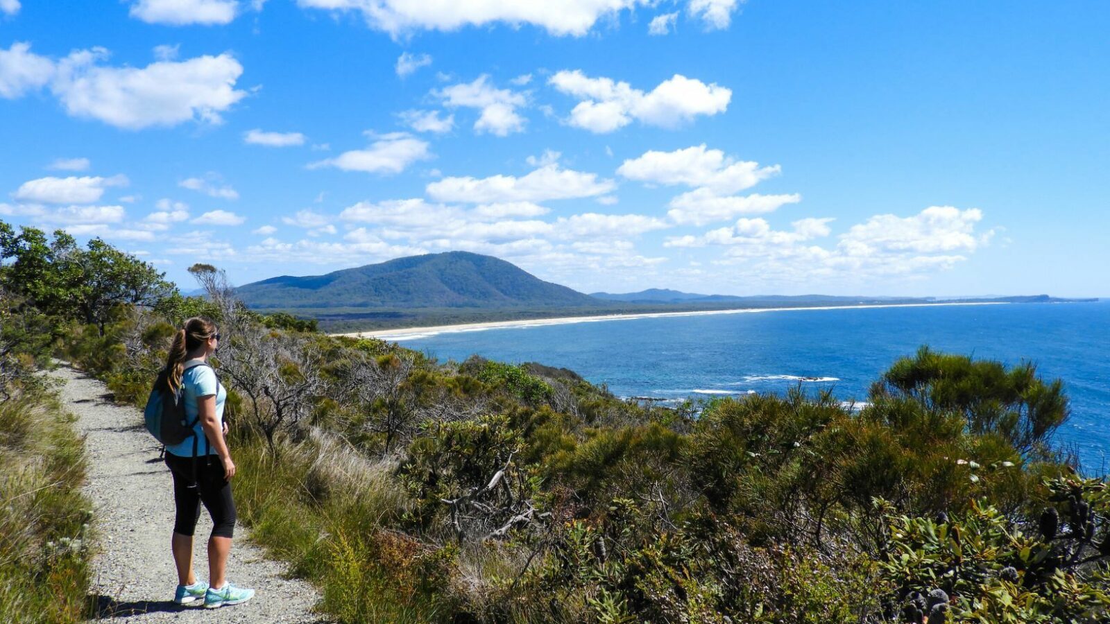
If you enjoy a challenging walk and scenic views rolled into one, then grab your hiking boots and make your way to Yacaaba Headland walking track.
This lightly challenging walk takes you up the southern-most headland of the Barrington Coast, in the southern reaches of Myall Lakes National Park. From the south end of Bennetts Beach, the track climbs steeply past stands of smooth barked angophoras, banksias and grass trees.
As the track veers north, take a break and admire the inspiring views up the coastline. On a clear day, the distant blue ridgeline of Barrington Tops is visible. The track gets rockier and steeper, but along the forested ridge top you’ll be treated to coastal views of Seal Rocks and Tomaree Headland.
Out to sea, Cabbage Tree Island, known as John Gould Nature Reserve, protects the only known breeding colony of one of the world’s rarest birds: Gould’s petrel.